0 写在前面
没有想保护的人,枪就成了无用的玩具~
1 基本介绍
Why Synthetic Aperture Radar (SAR)?:


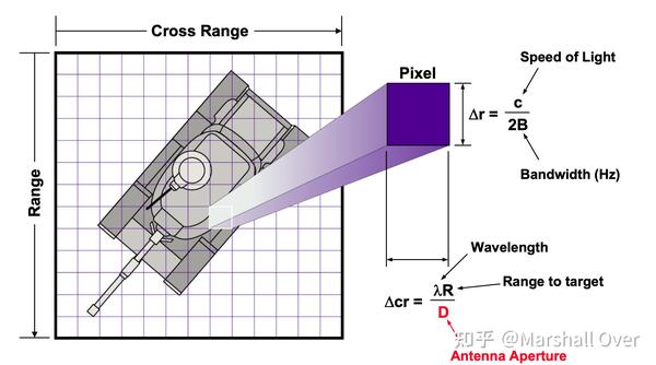
雷达图像:成像需要大的孔径。

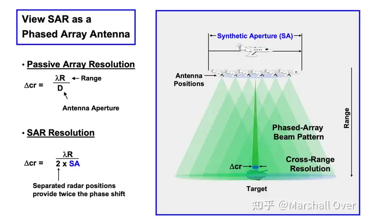
Synthetic Aperture Radar (SAR):


Cross-Range Resolution with SAR:

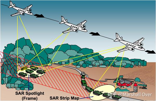
SAR Data Gathering Modes:

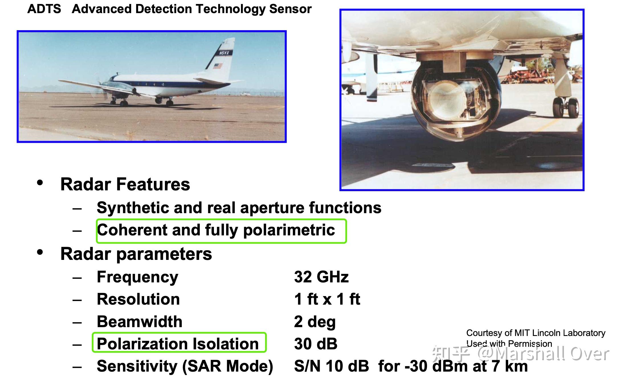
ADTS Radar:

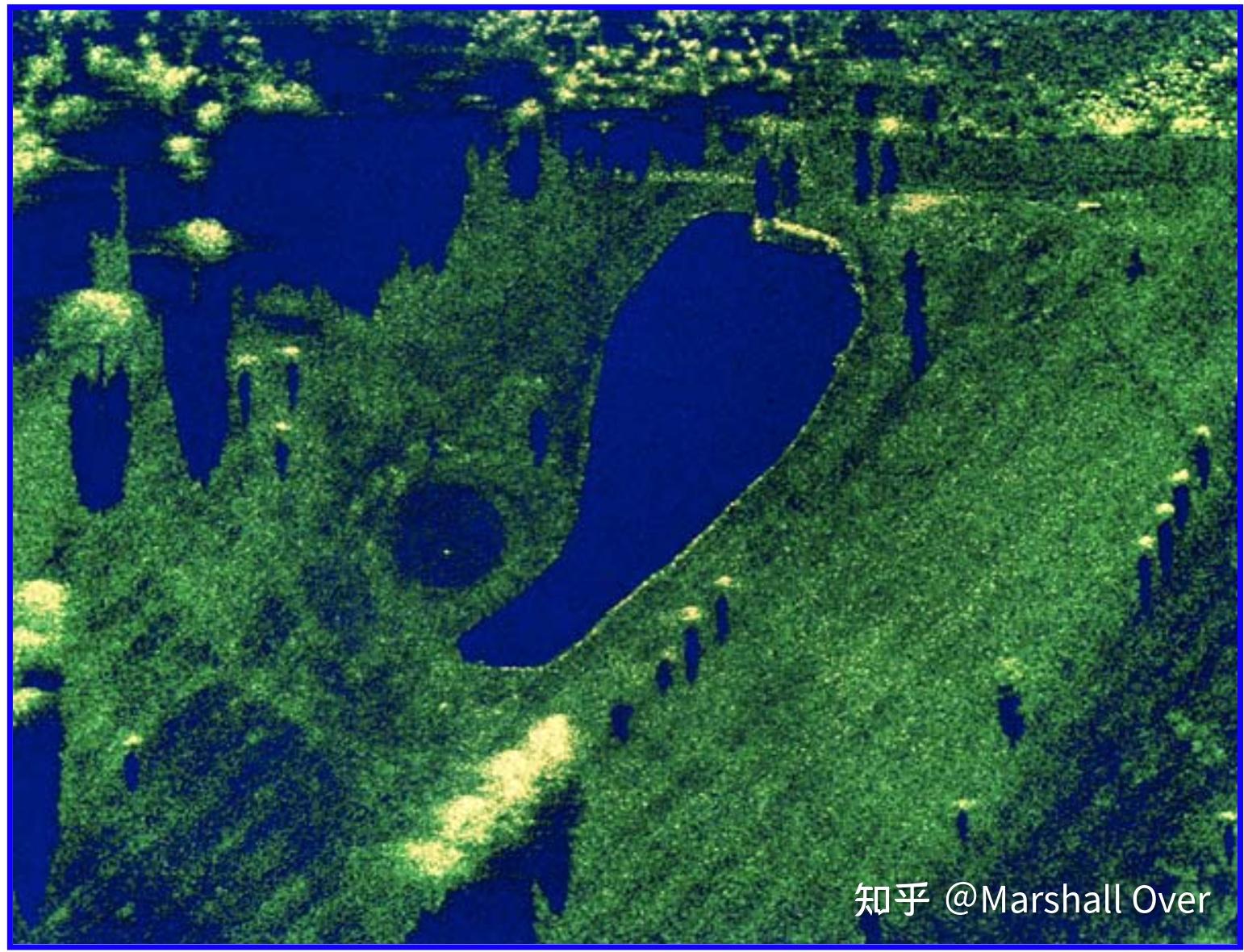
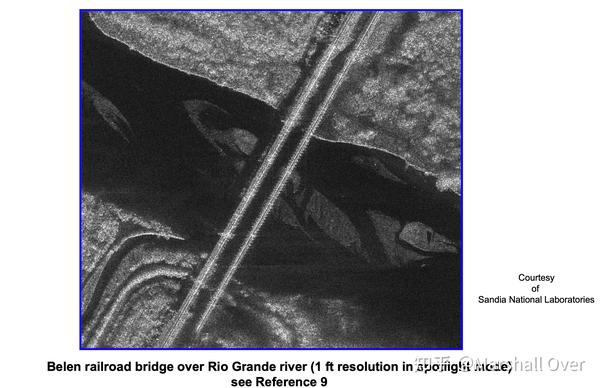
35 GHz SAR Image of Golf Course:高的距离和方位分辨率。

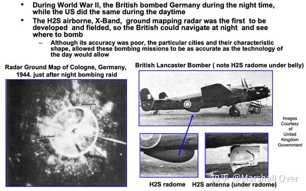
Radar Ground Mapping in World War II:

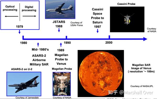
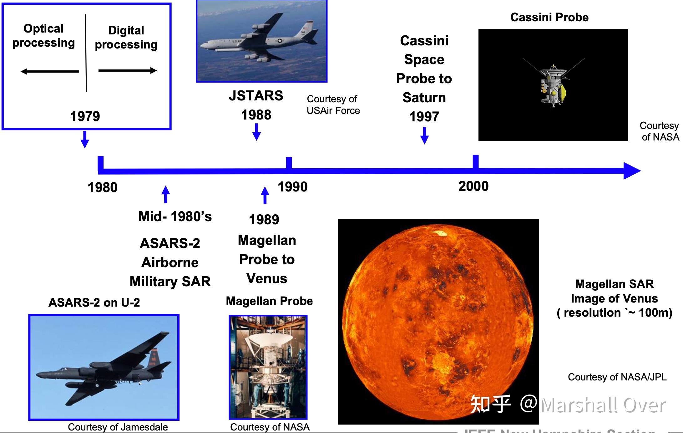
History of Synthetic Aperture Radar:
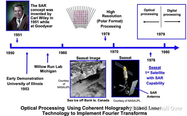
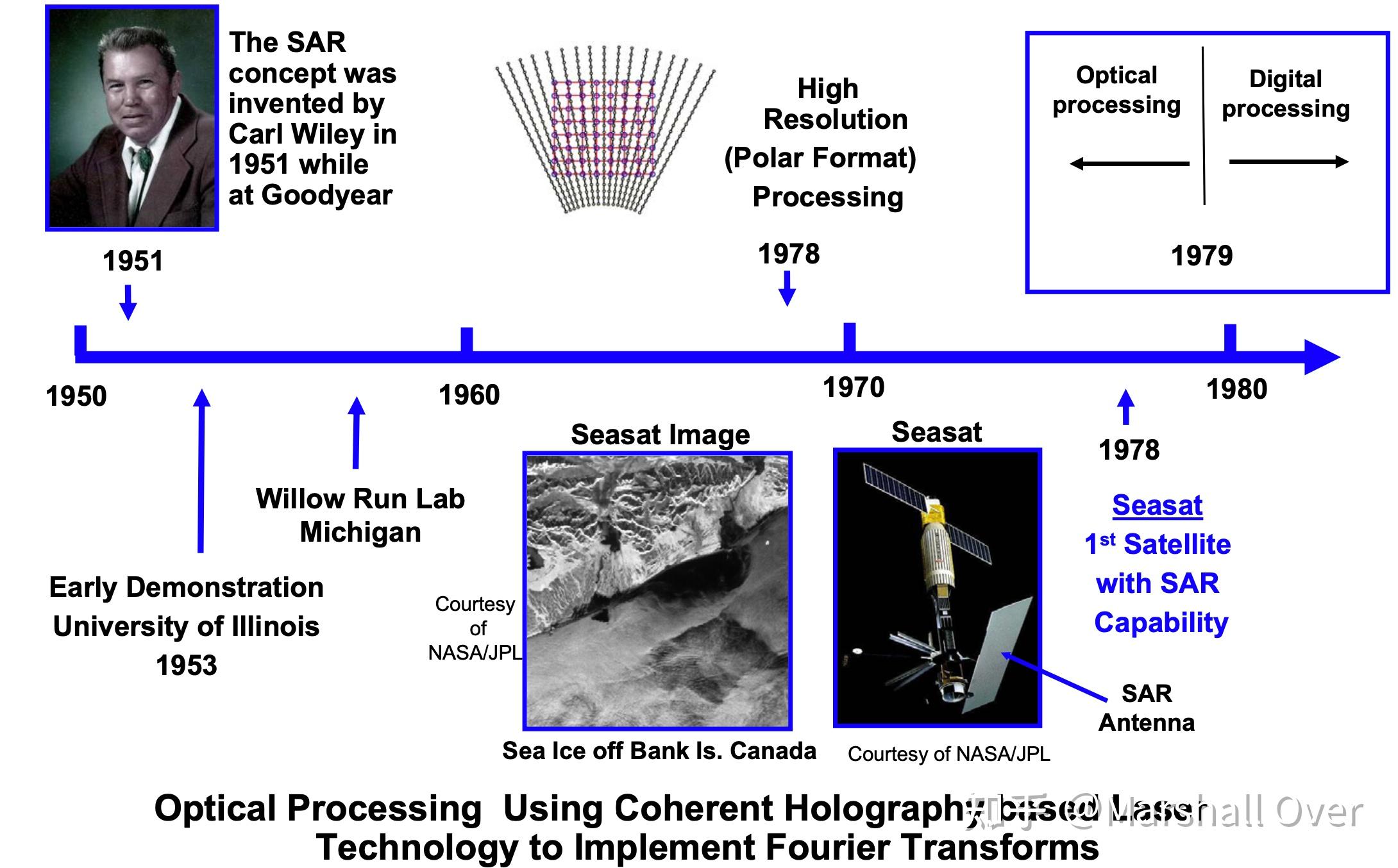
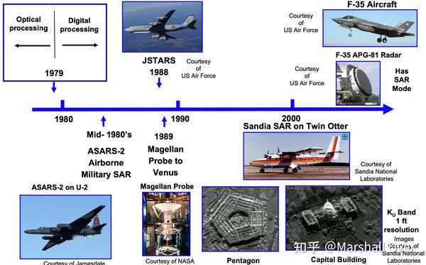

Evolution of SAR Resolution:

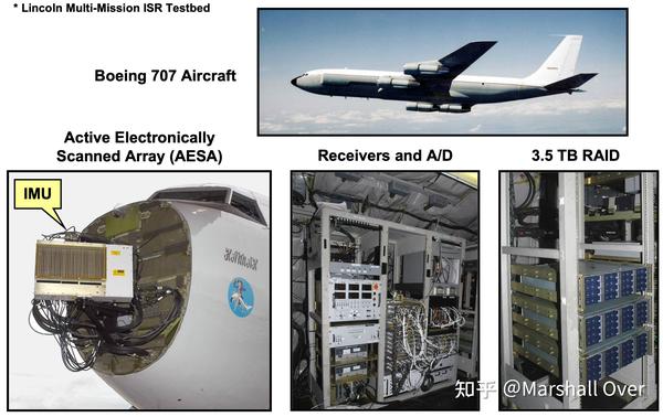
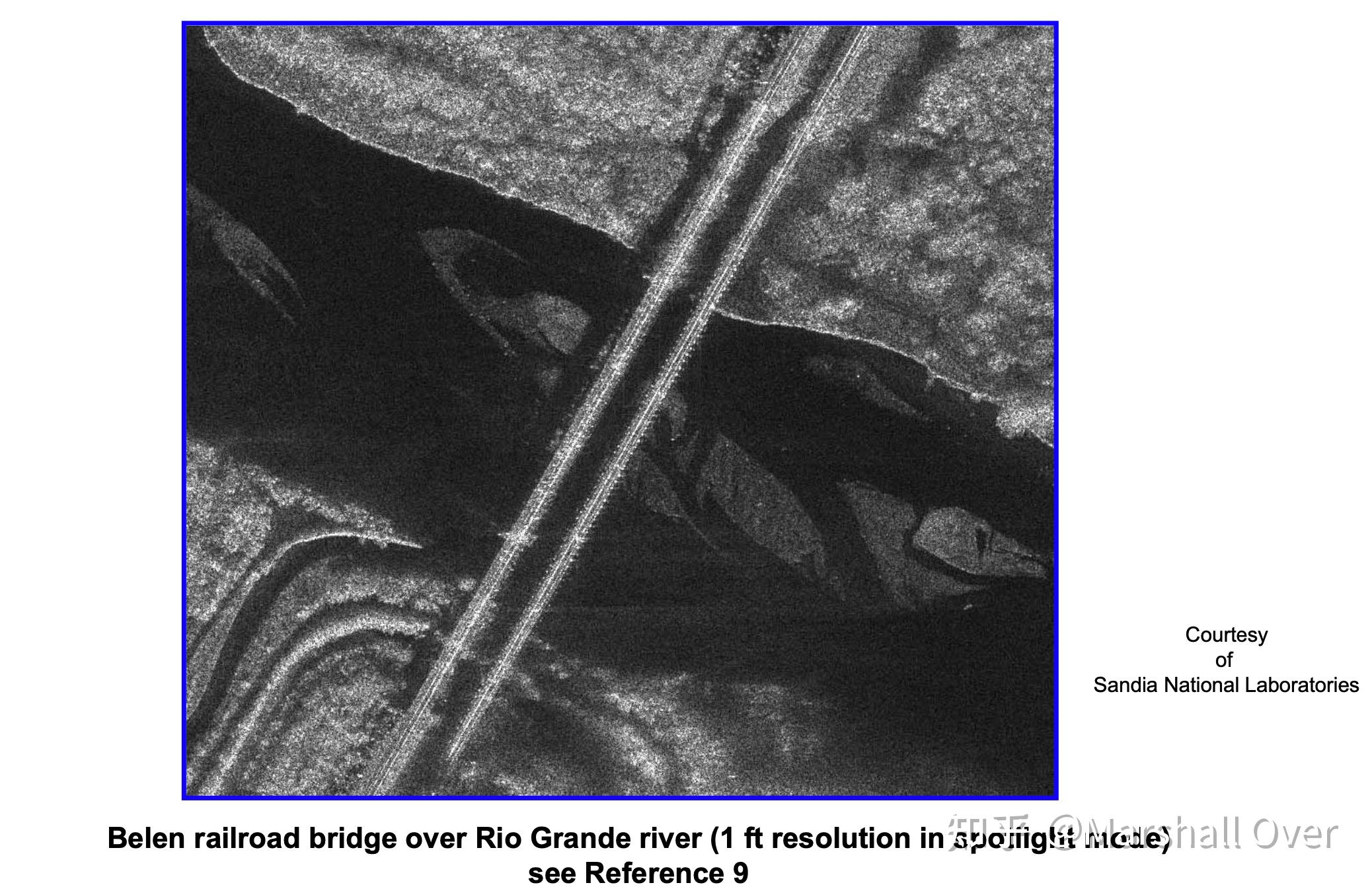
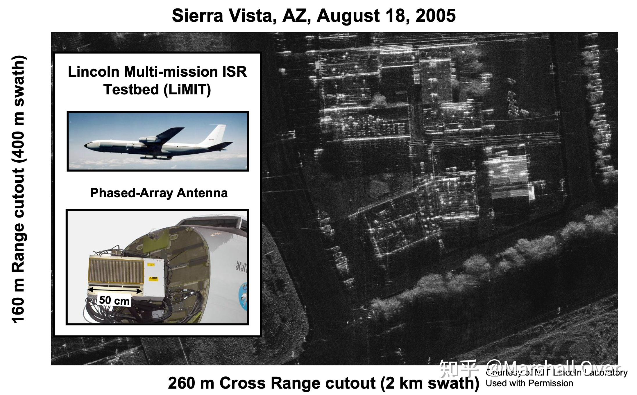
LiMIT* SAR Installation on 707:
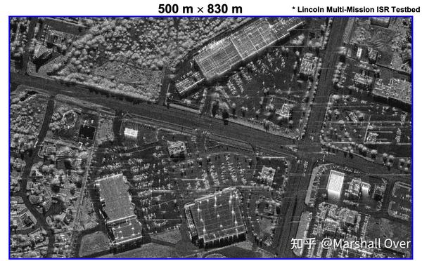
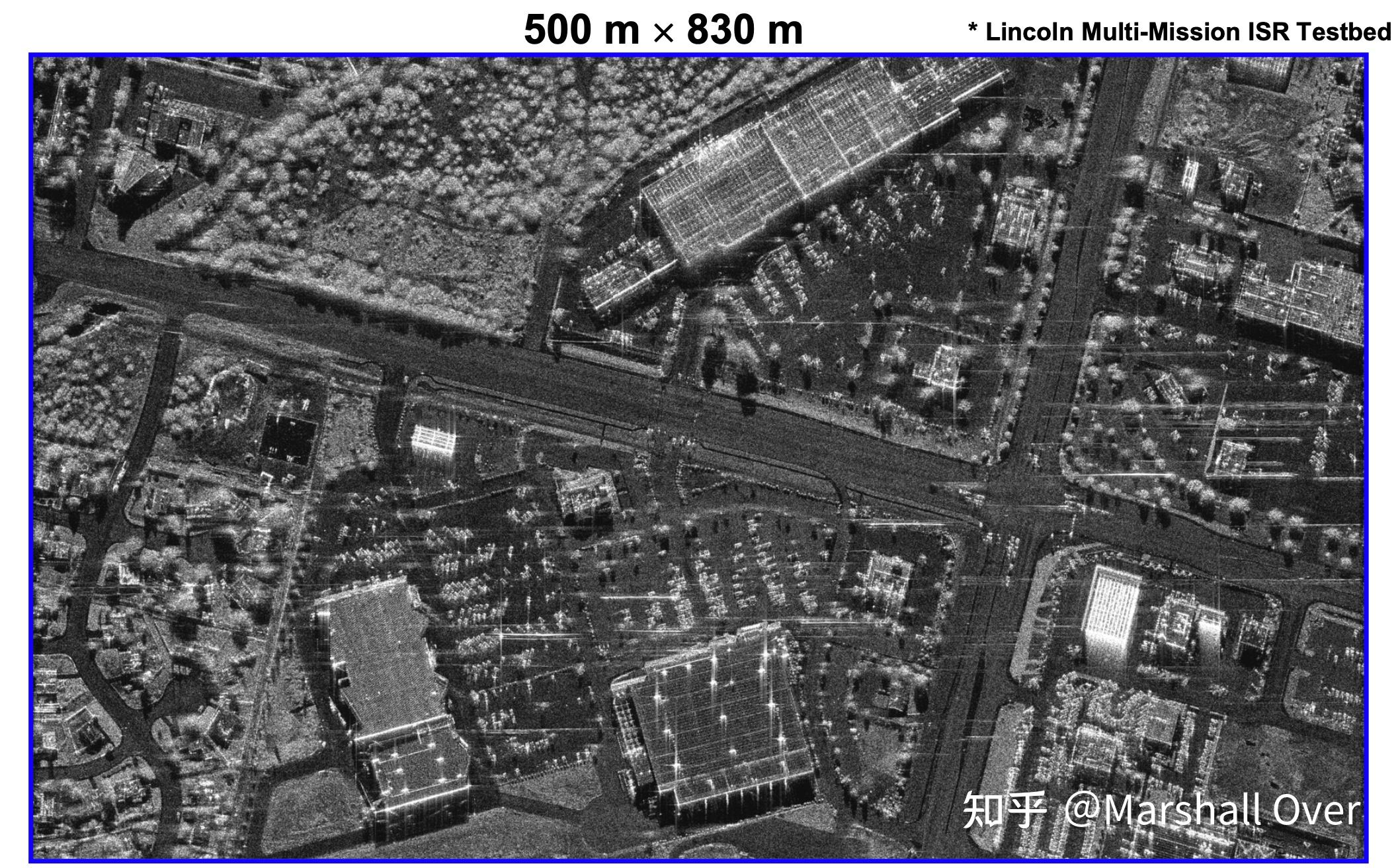
Sierra Vista, AZ, 16 August 2005 30 cm Limit* SAR:
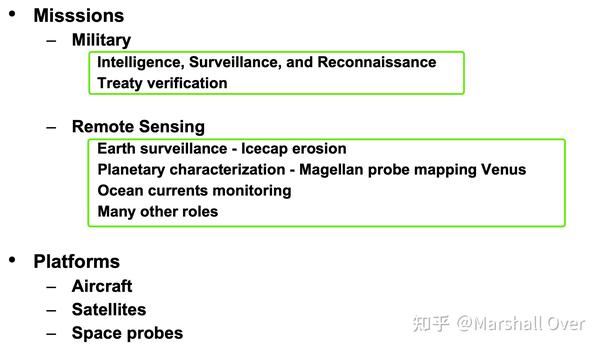
Missions and Platforms:
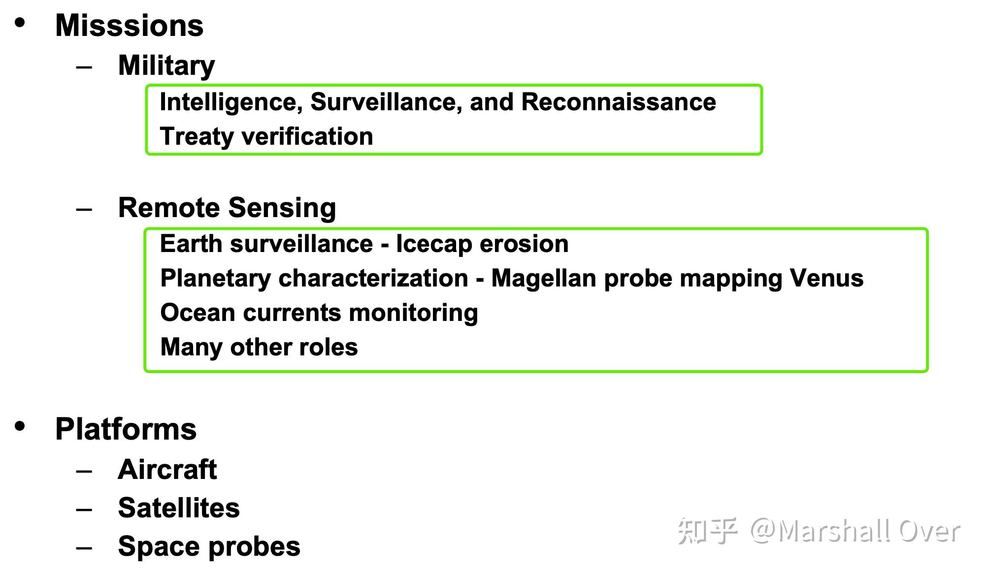
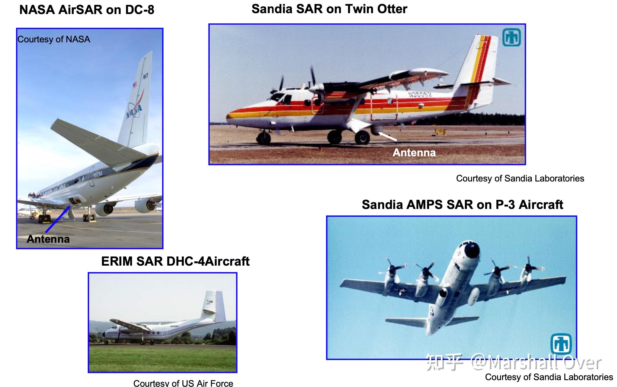
SAR Platforms – Airborne Systems:
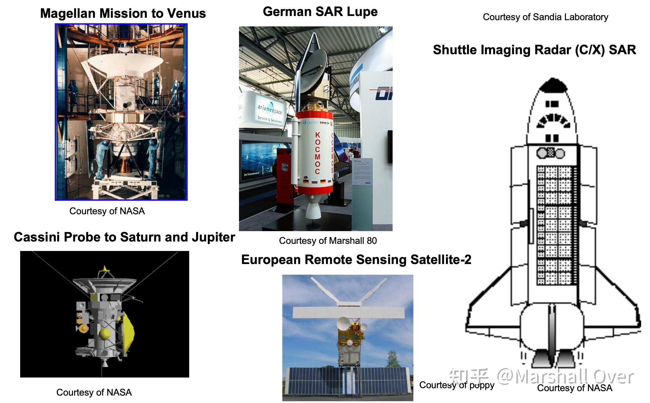
SAR Platforms – Satellites / Space Probes:

SAR Airborne Platforms for Remote Sensing:

2 SAR基础
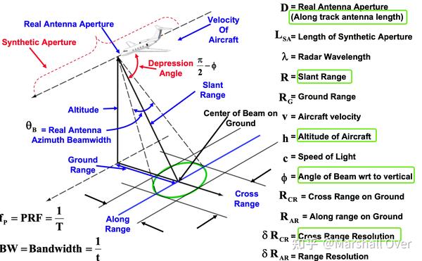
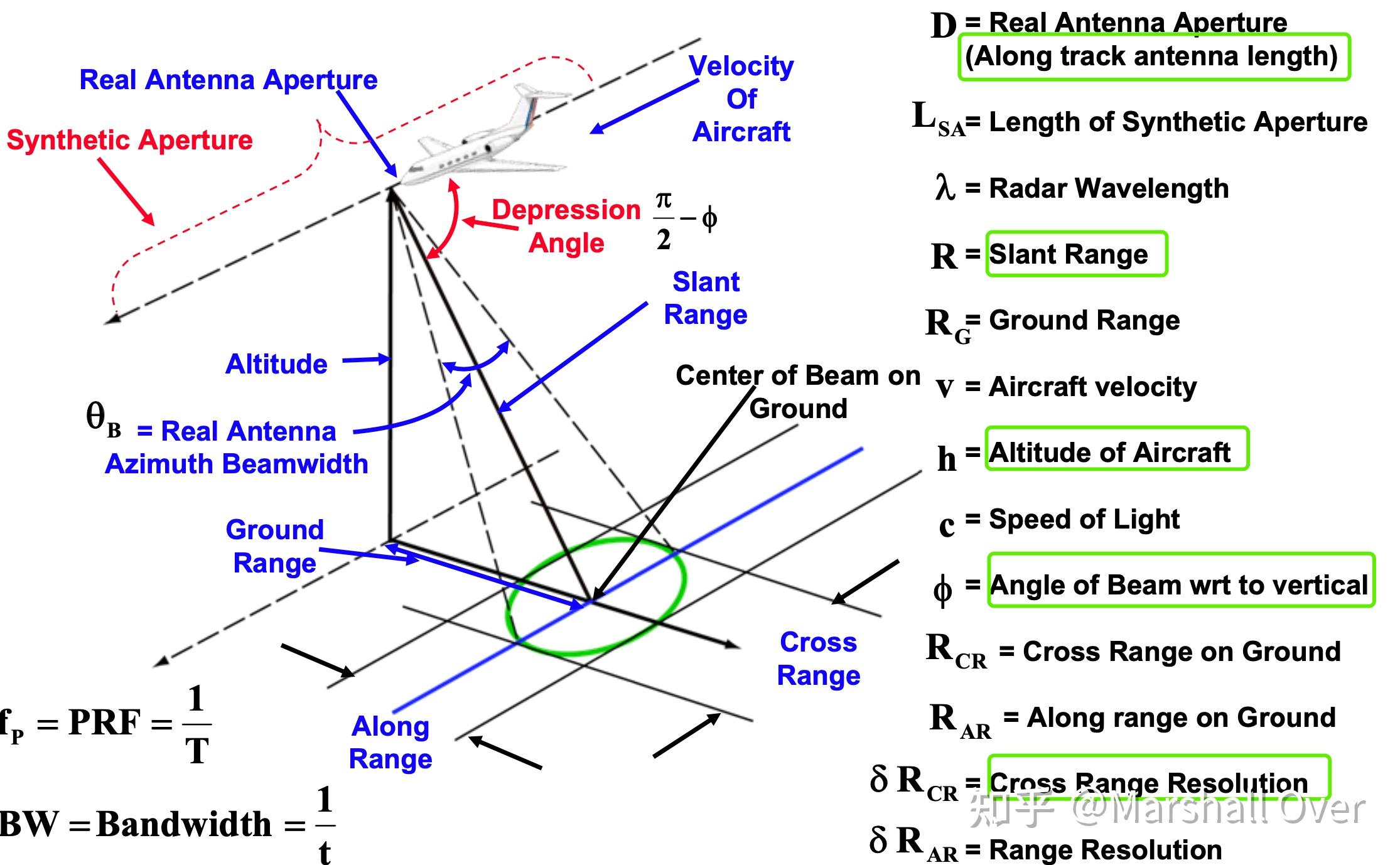
Airborne SAR Geometry:
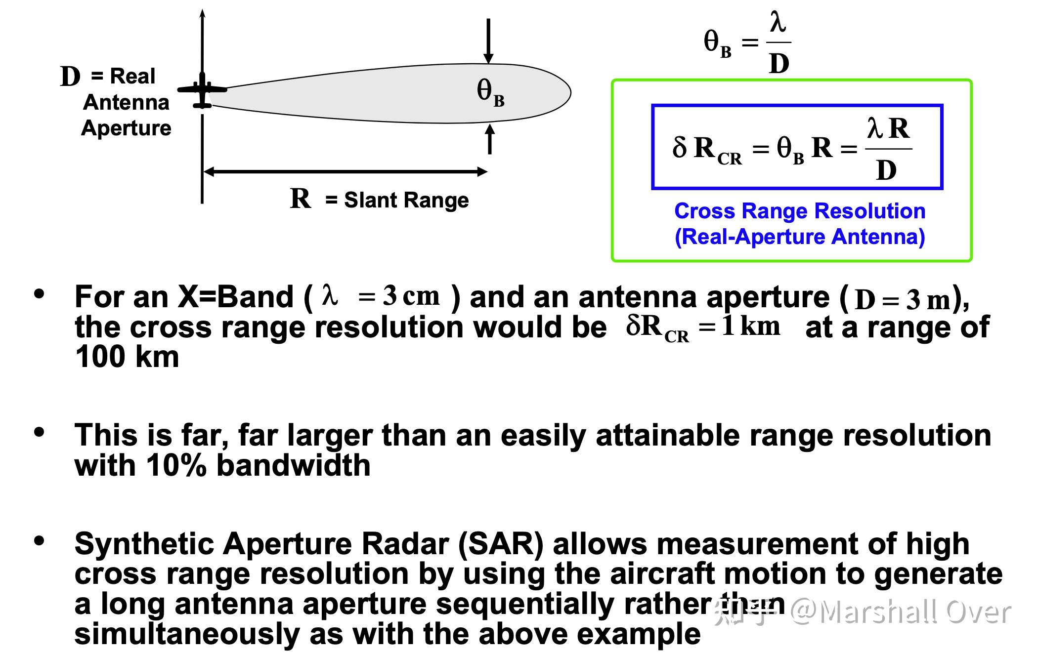
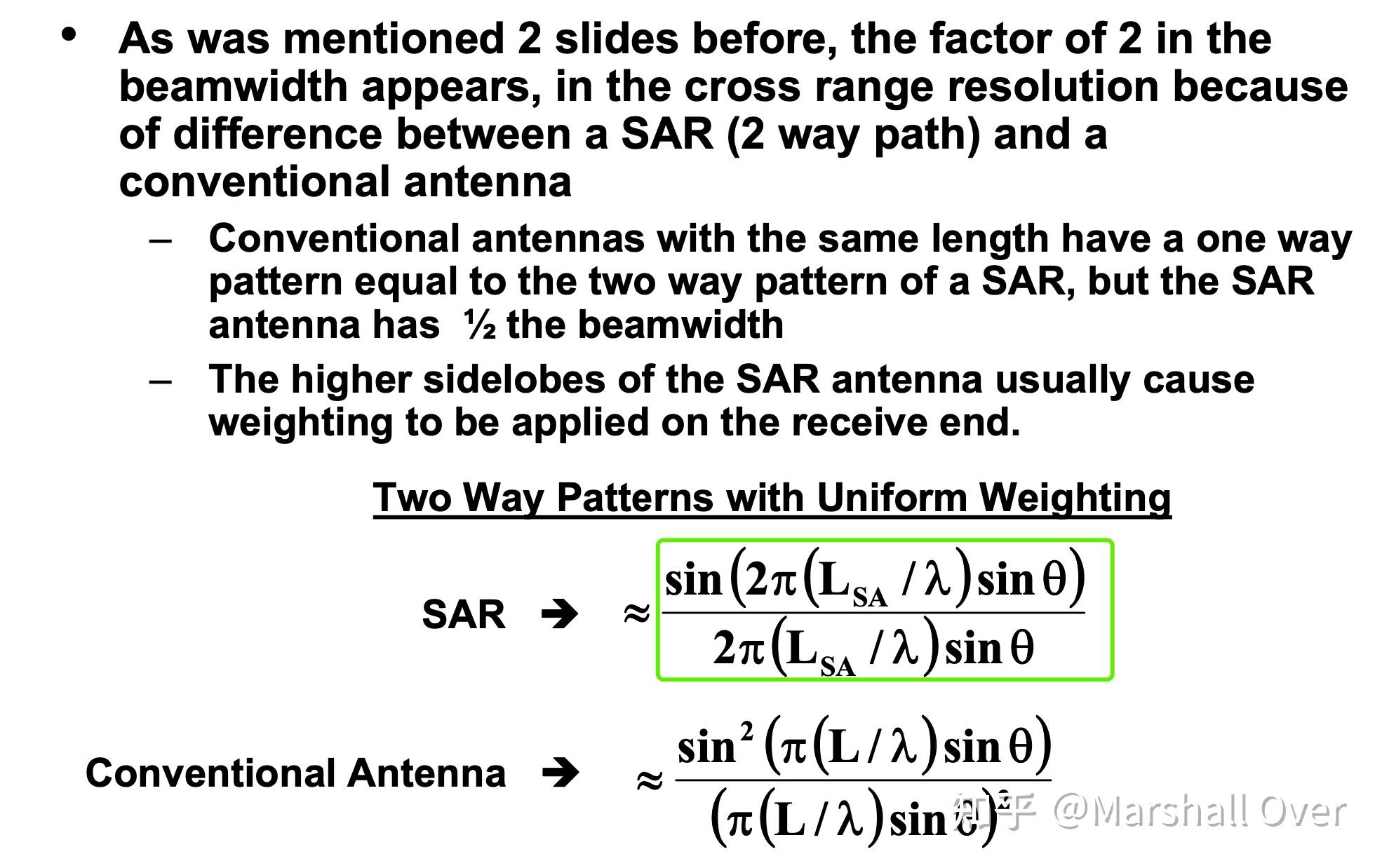
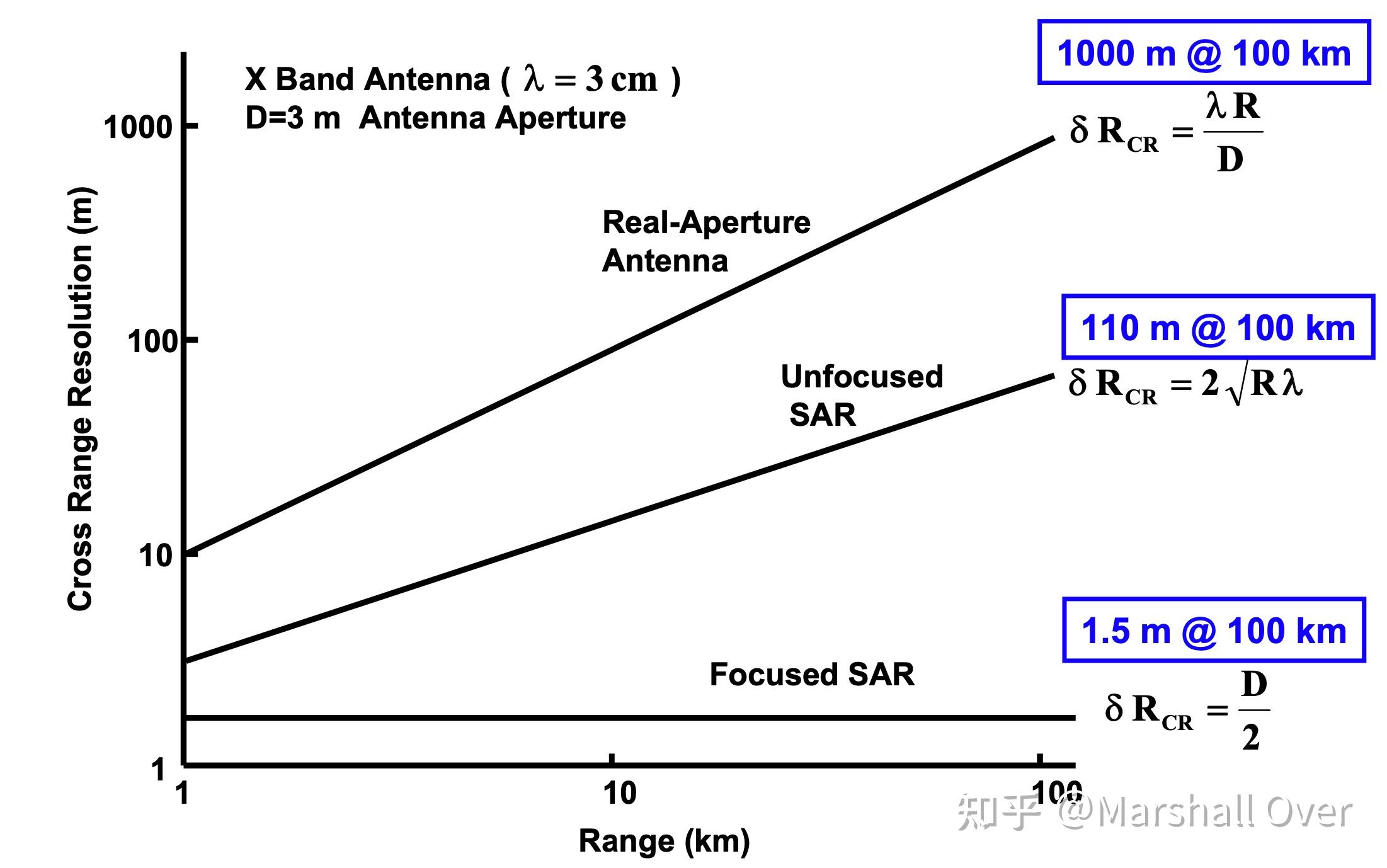
Cross Range Resolution Limits (Real Aperture Radar):

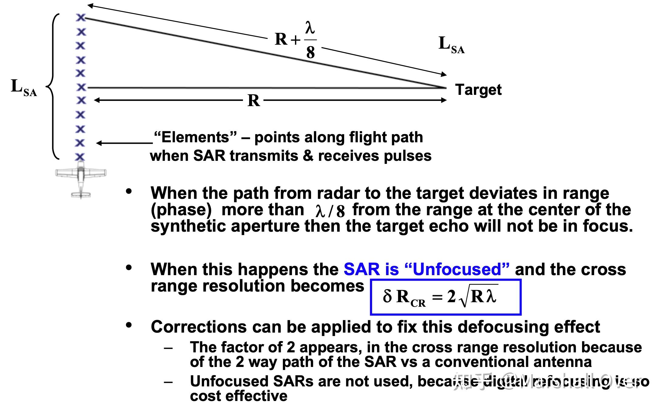
Cross Range Resolution Limits (Unfocused Synthetic Aperture Radar):

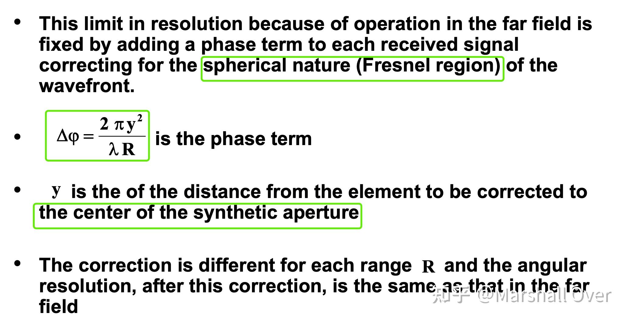
Cross Range Resolution Limits (Focused Synthetic Aperture Radar):


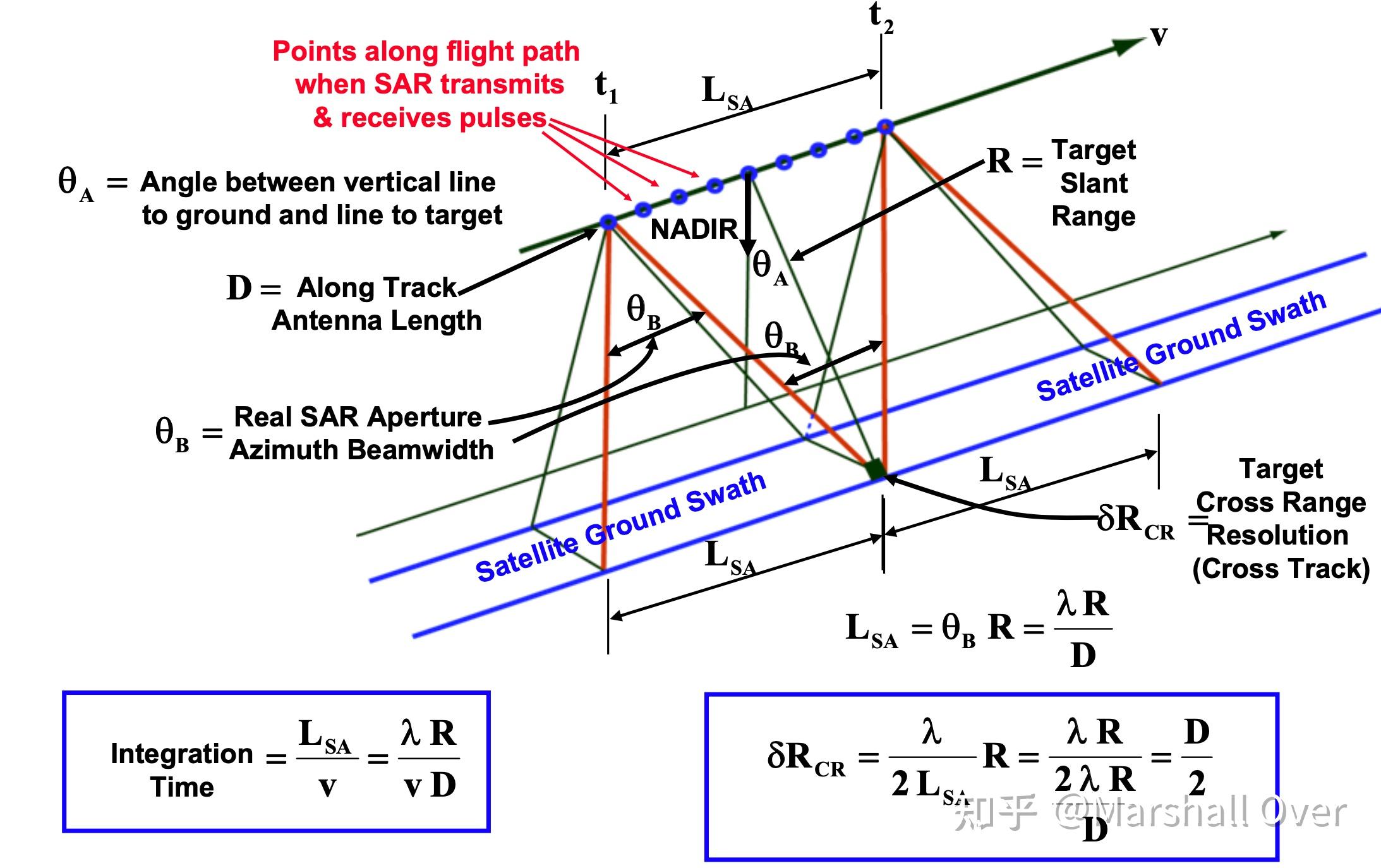
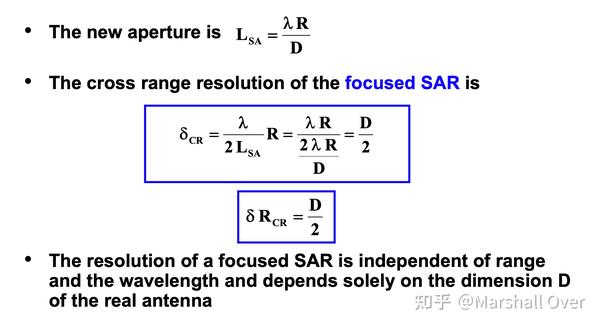
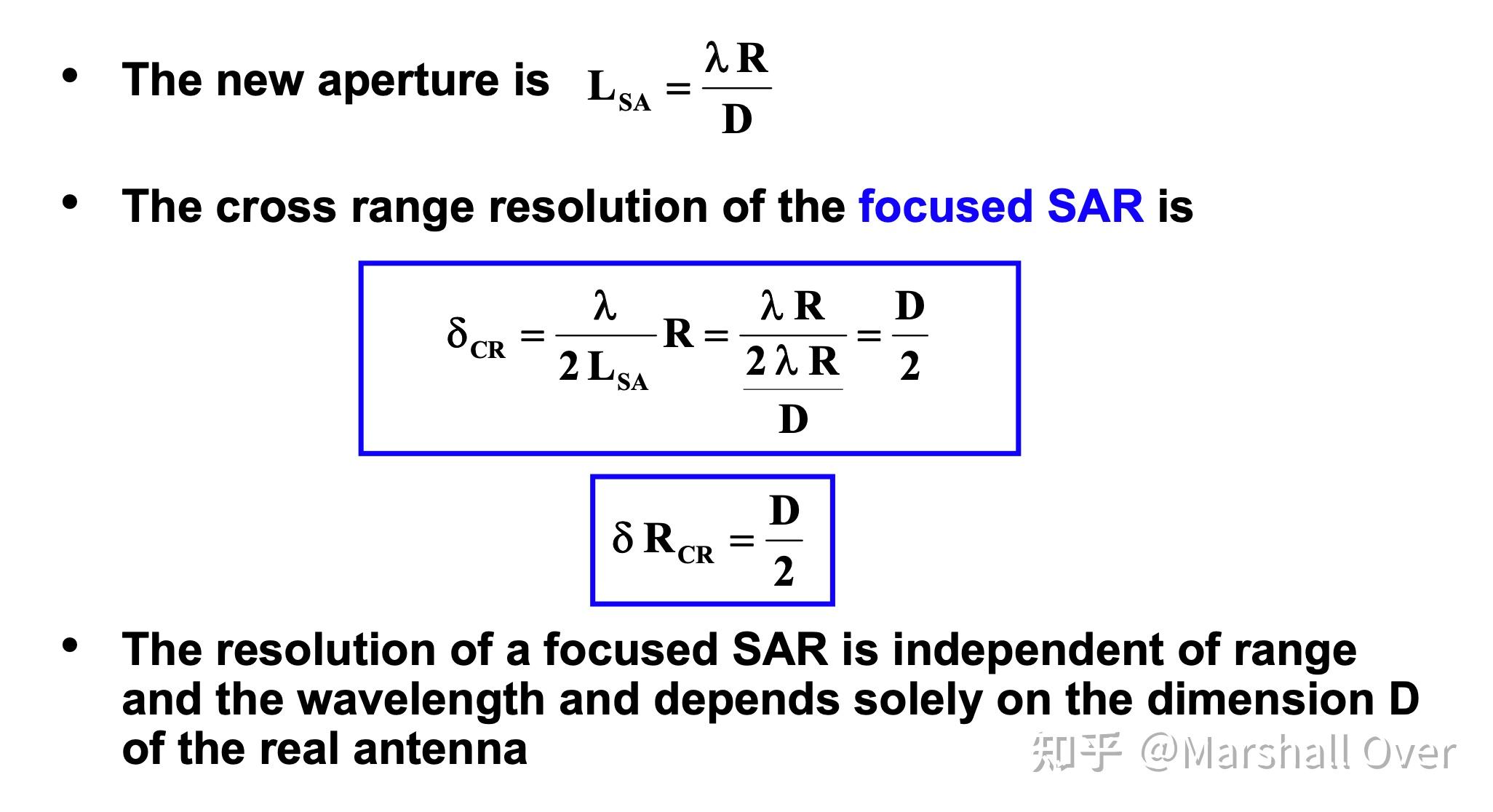

Radar Cross Range Resolution:
Constraints on Resolution and Swath Size:
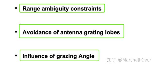
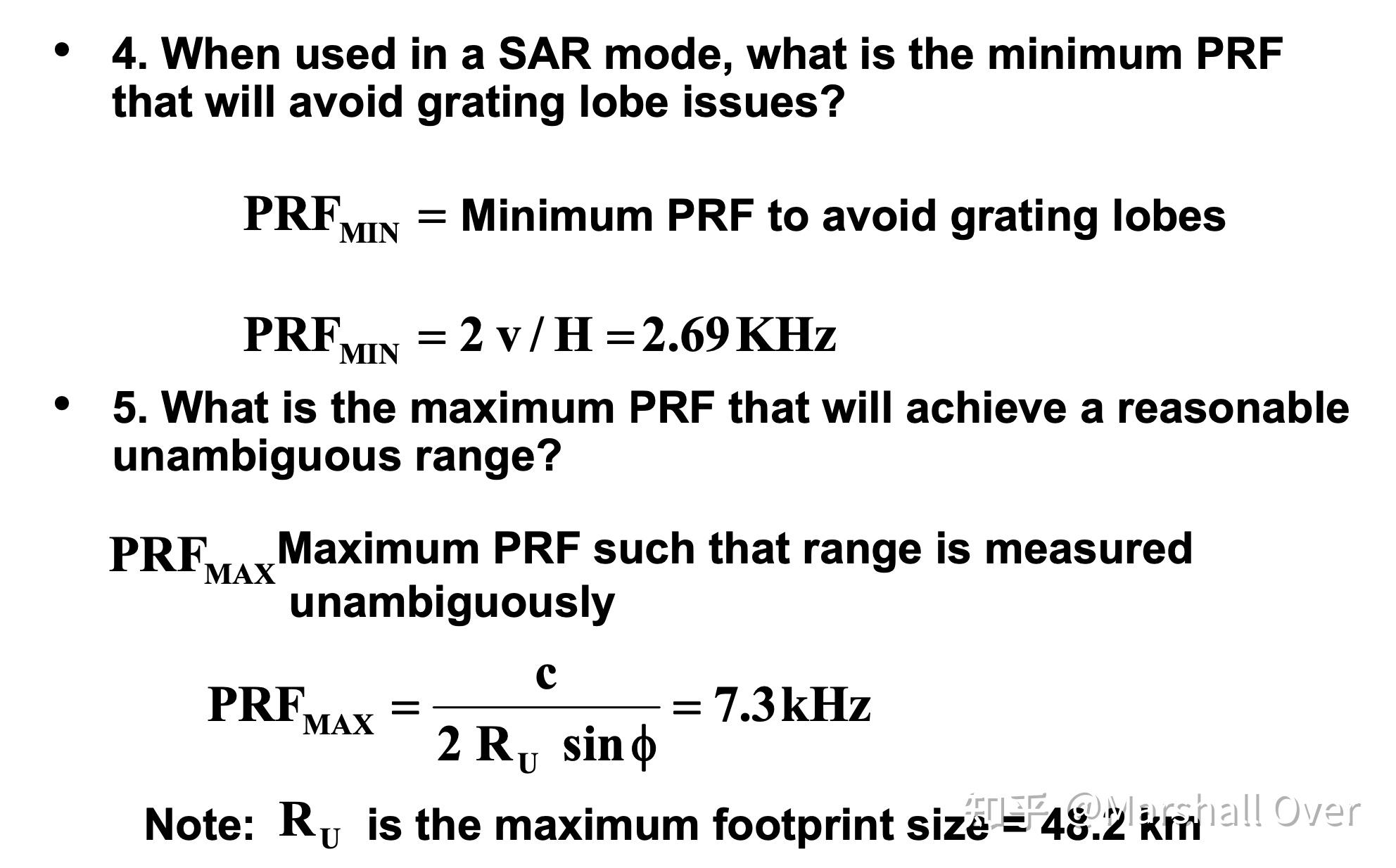
Range ambiguity Constraints:

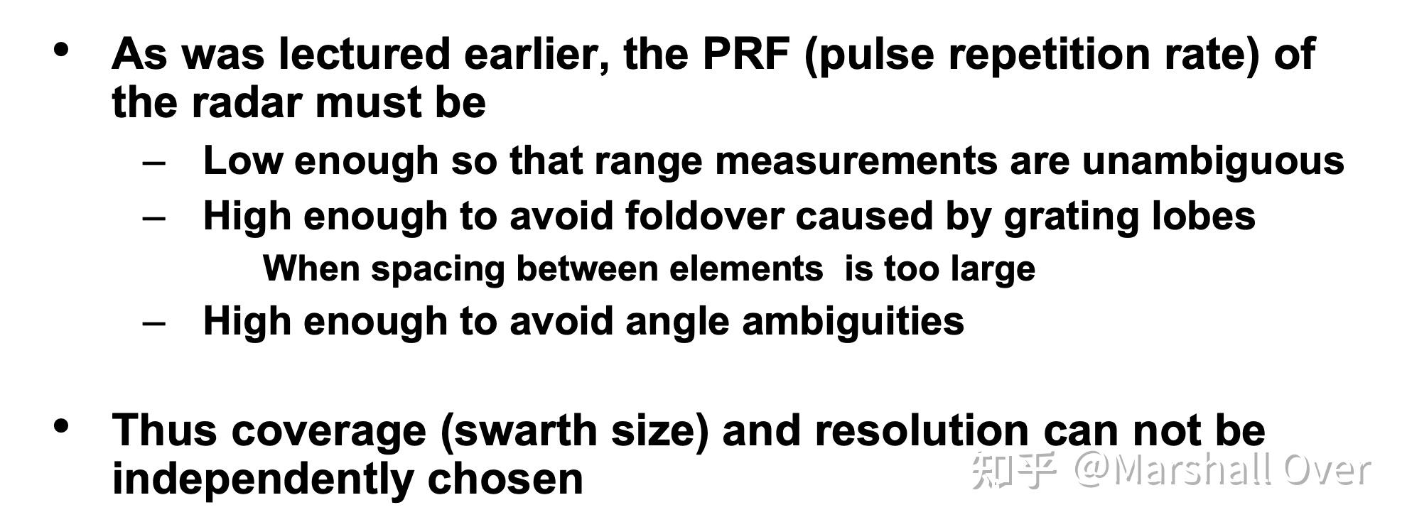
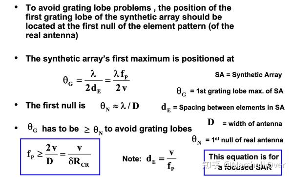
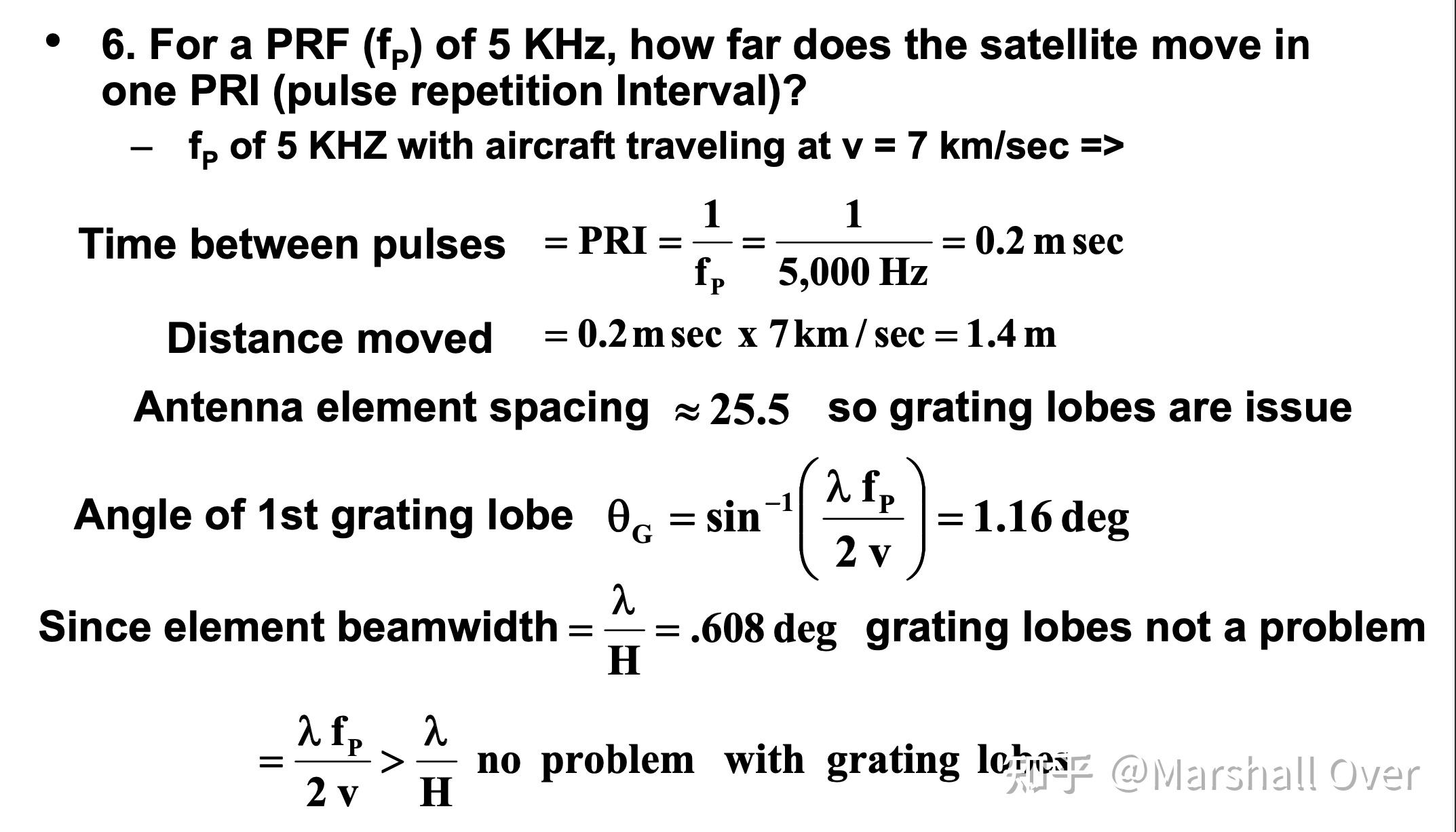
Avoidance of antenna grating lobes:
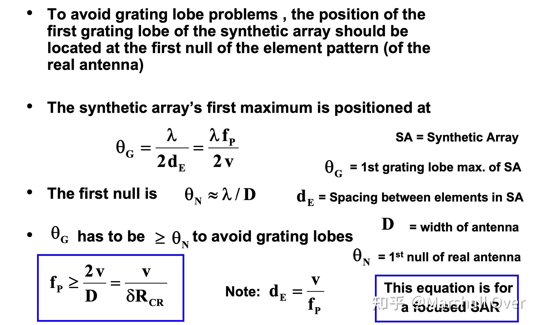
Avoidance of antenna grating lobes:

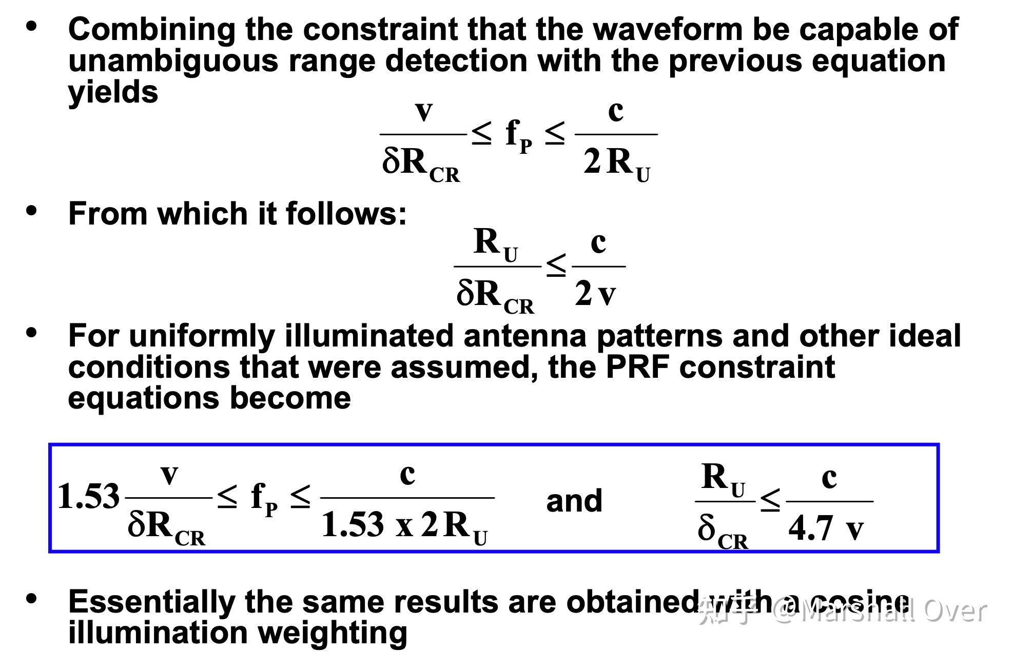
Influence of Grazing Angle:

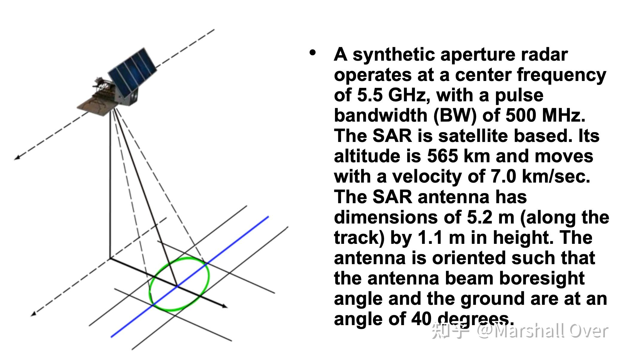
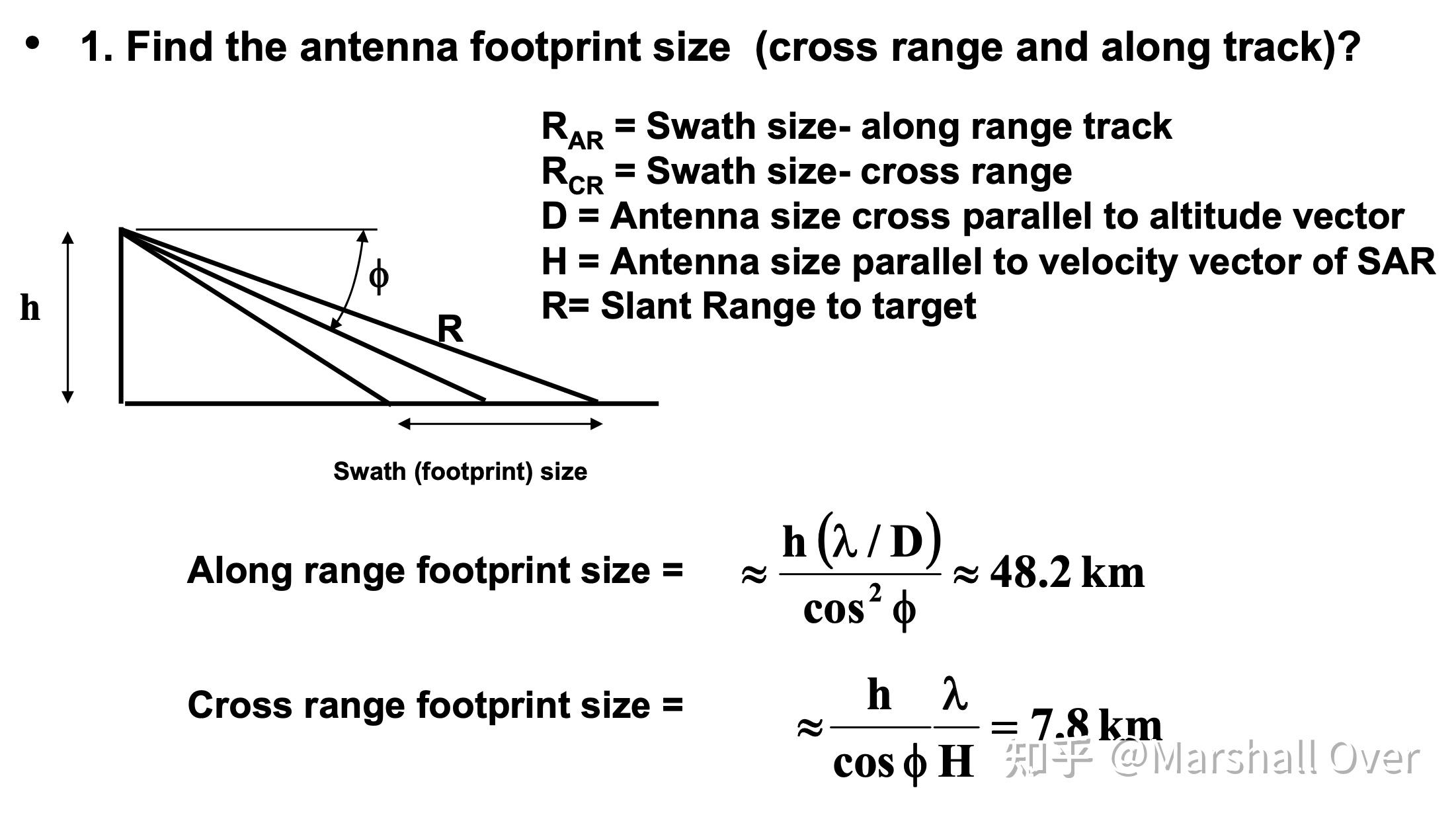
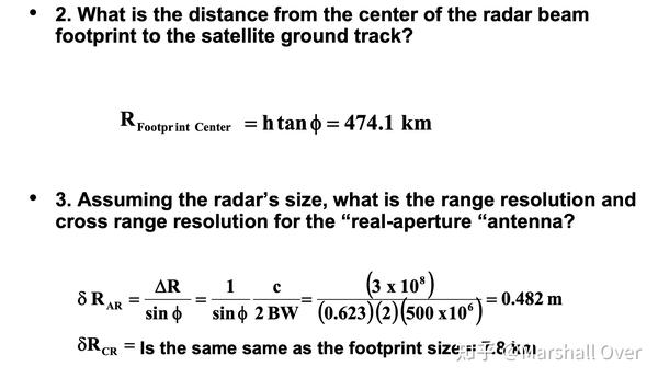
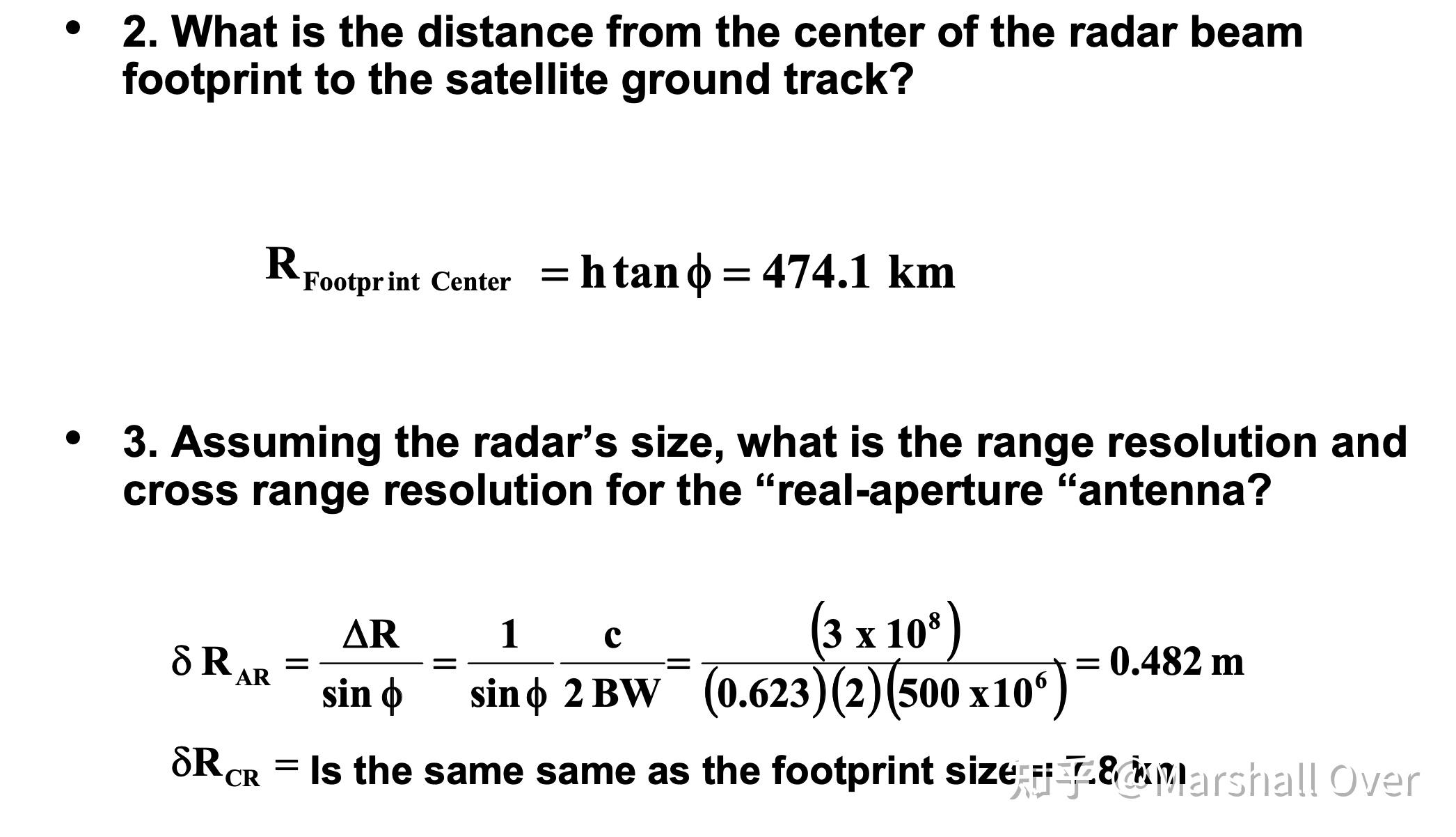
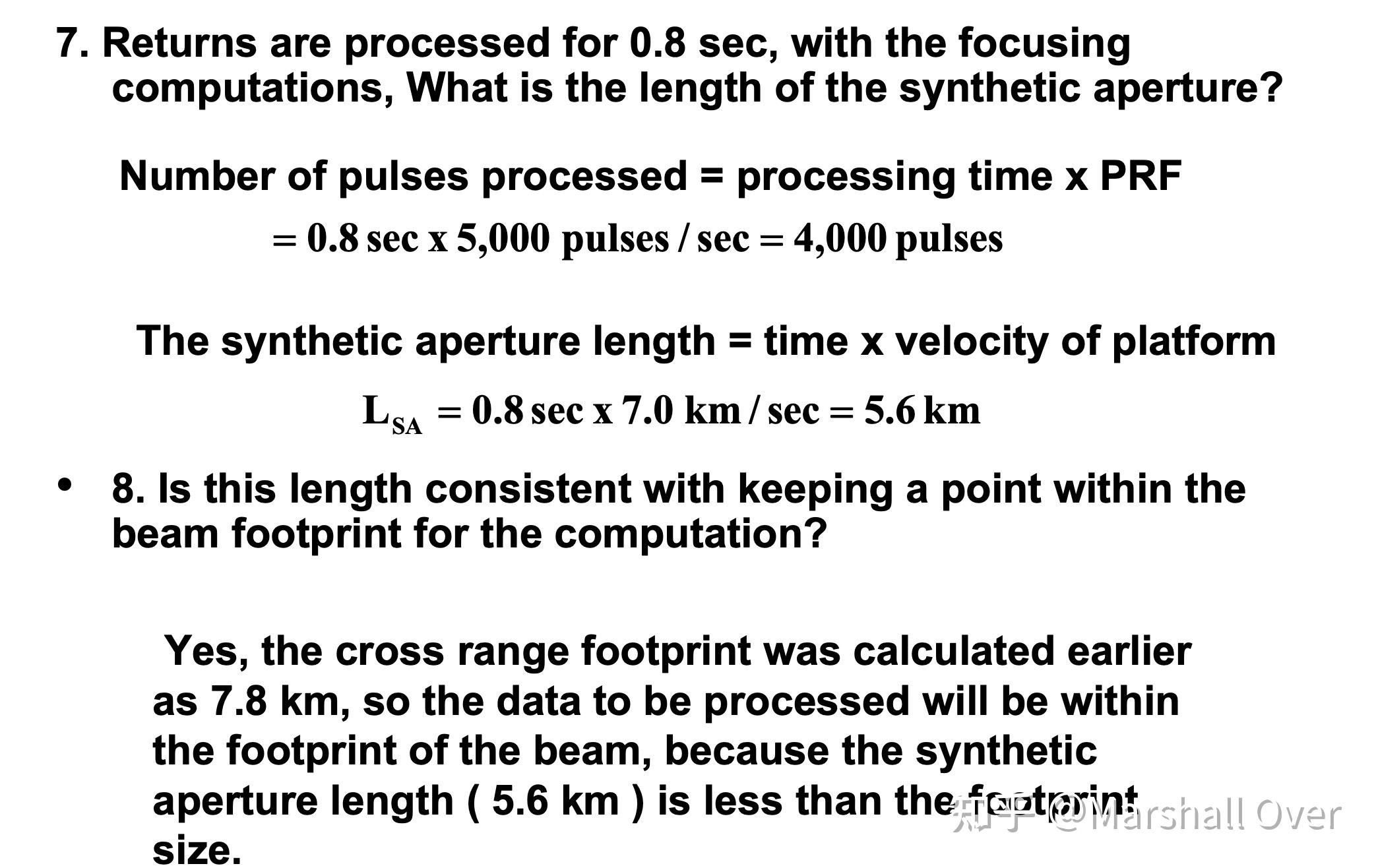
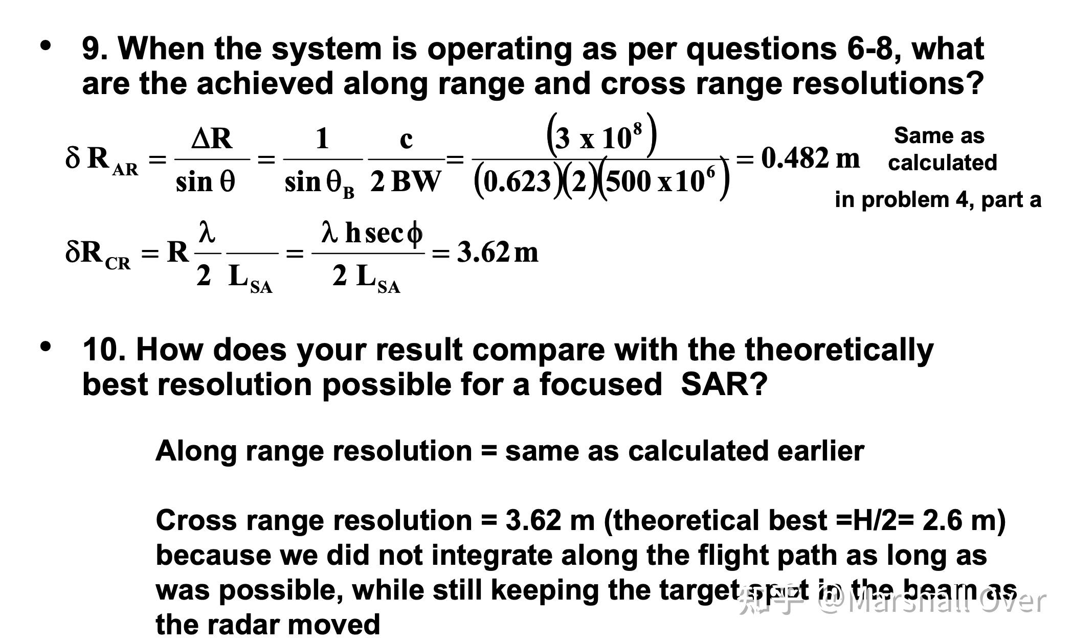
Focused SAR Example:


3 图像形成
SAR Processing Flow:
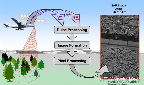

Pulse Processing (LiMIT Example):

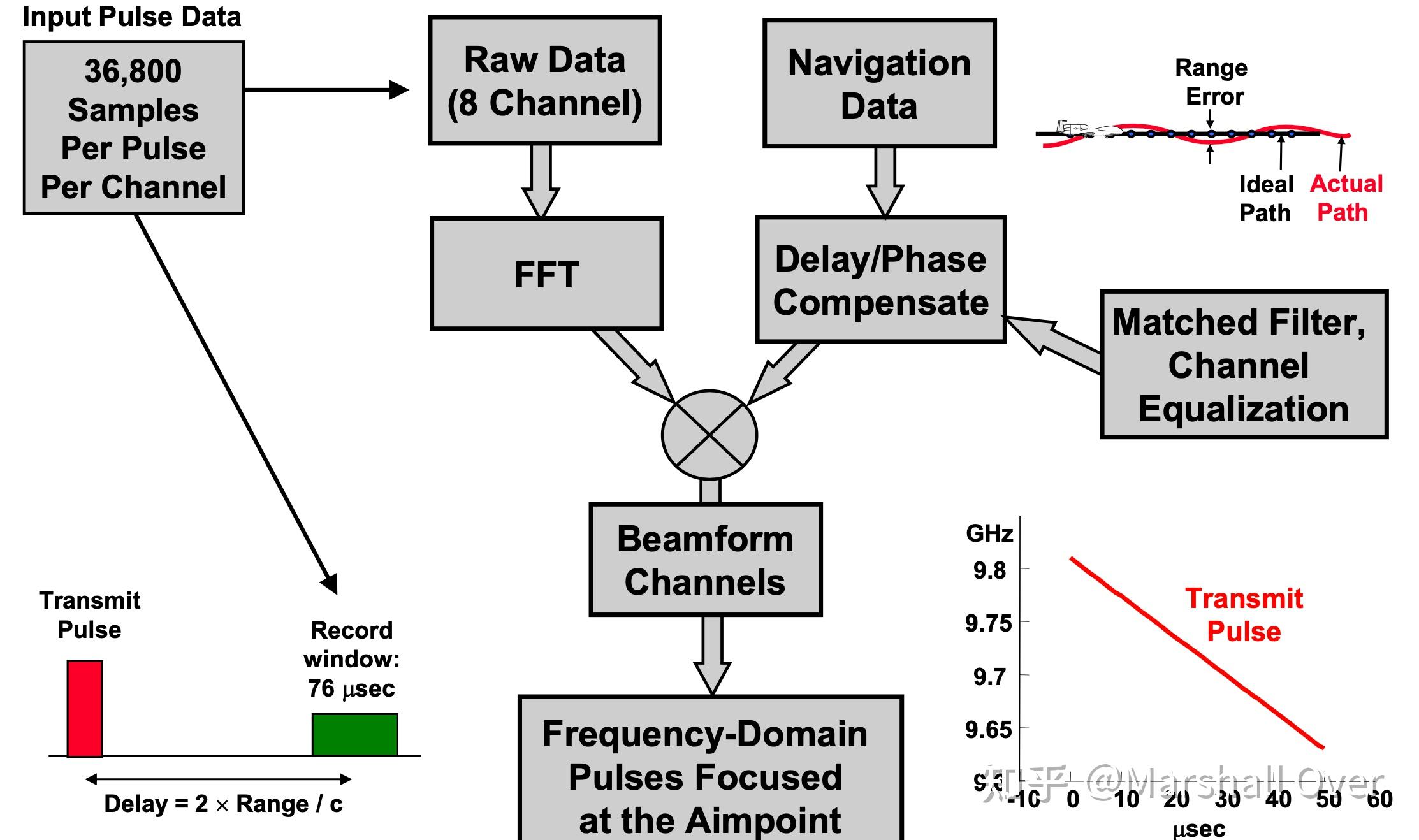
Image Formation Issues:

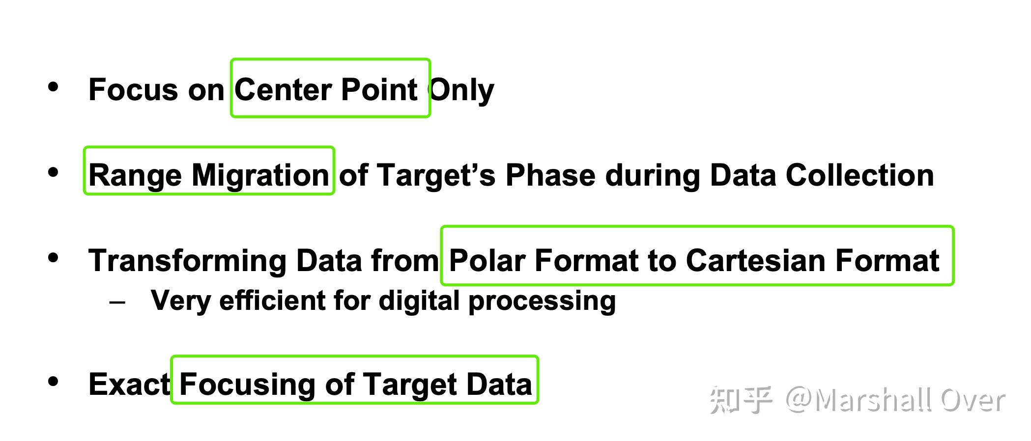
Image Formation:
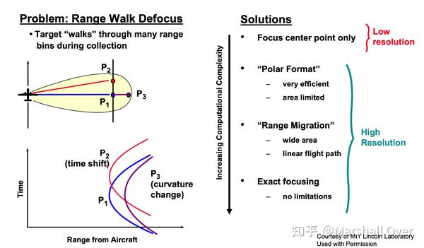
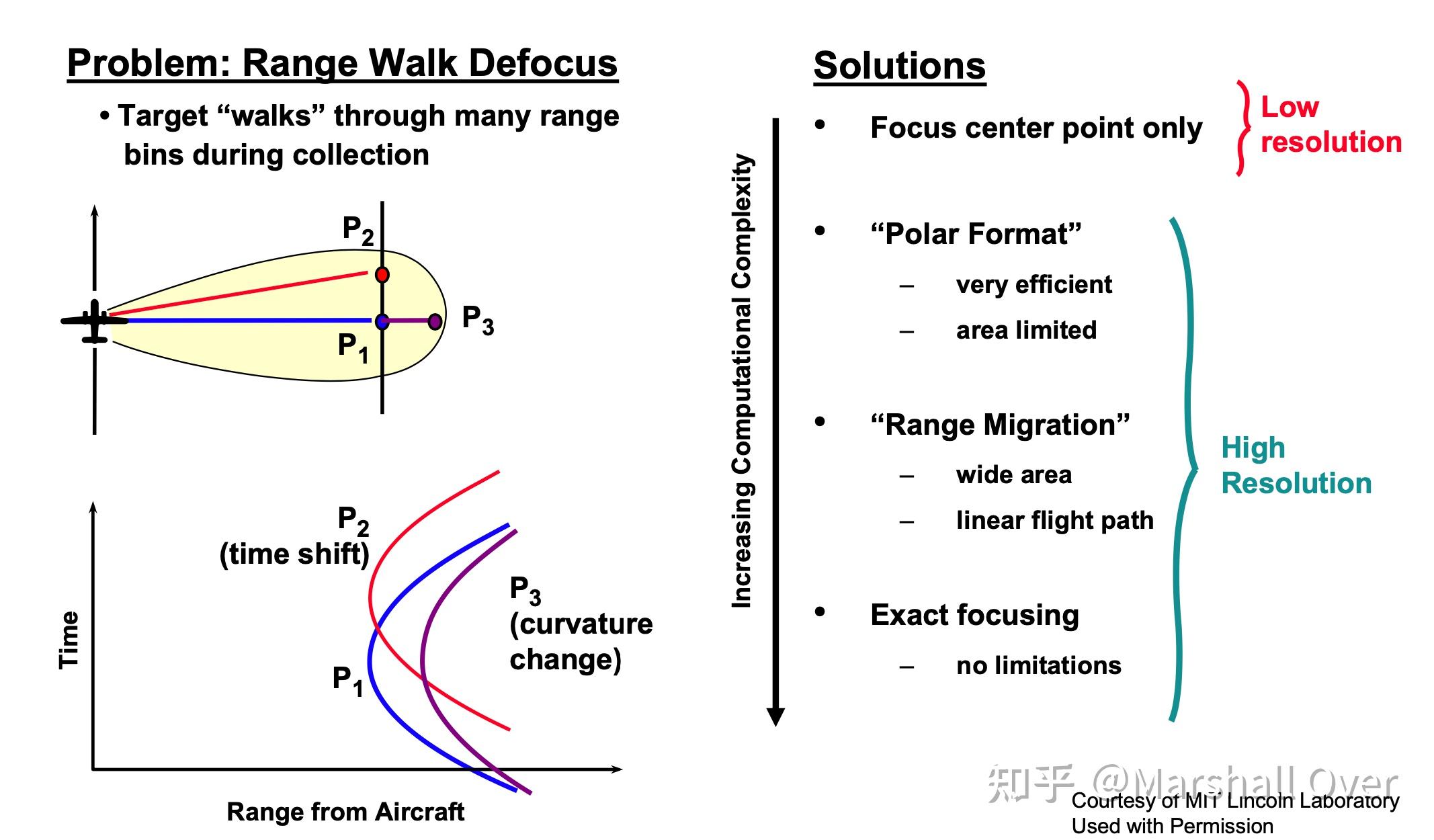
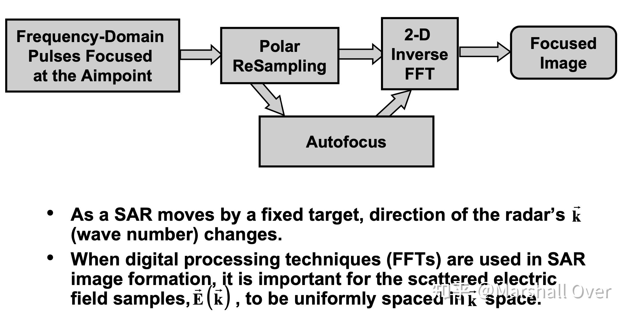
Image Formation Block Diagram:

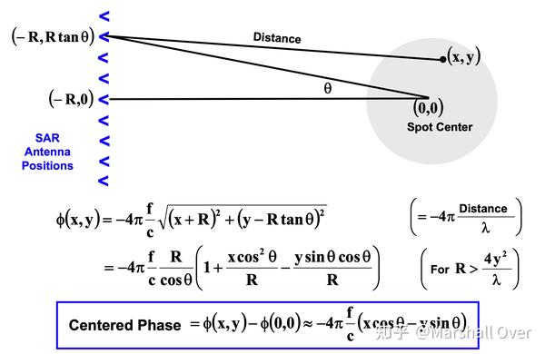
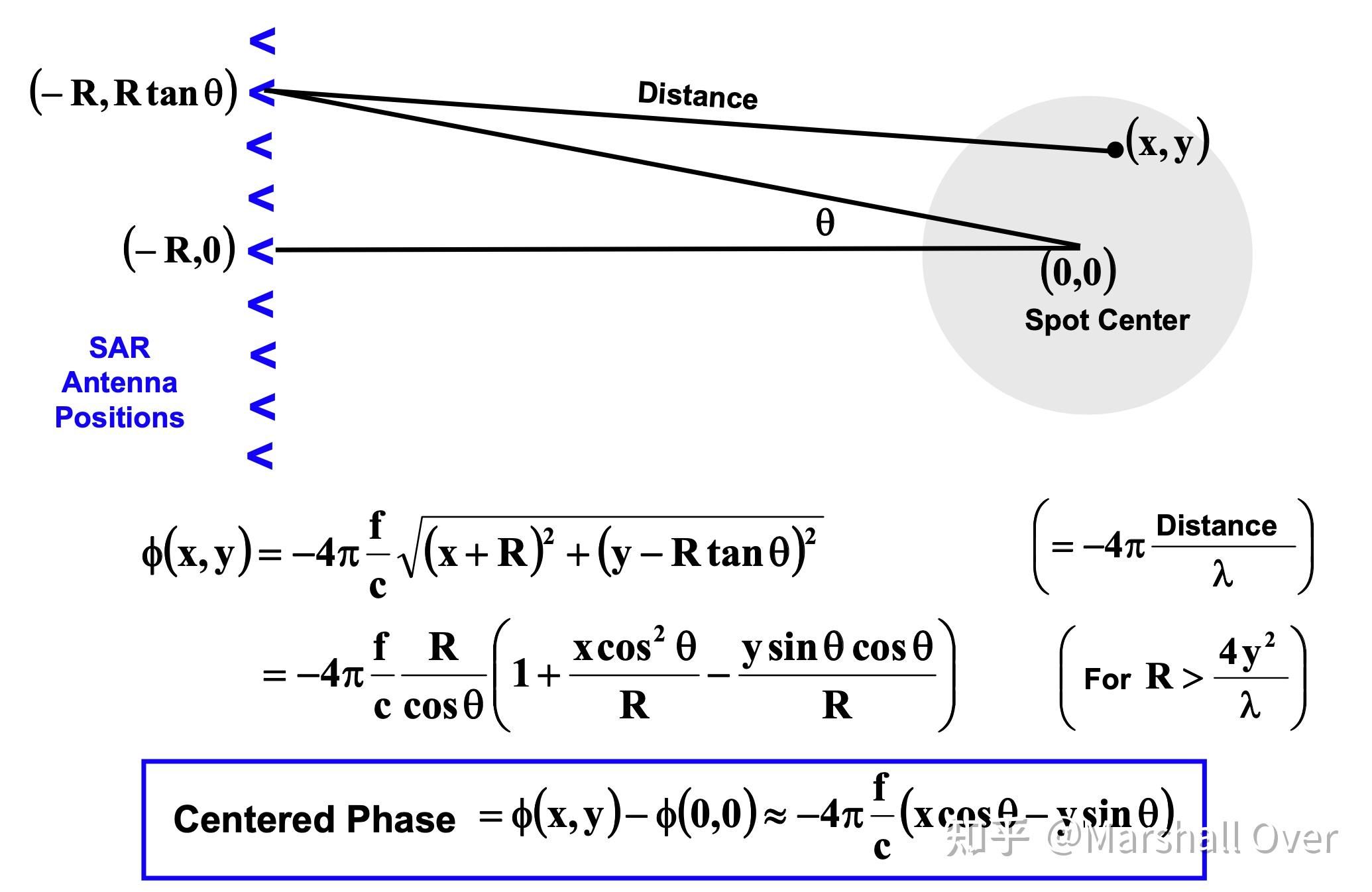
Far-Field Spotlight Phase Response:
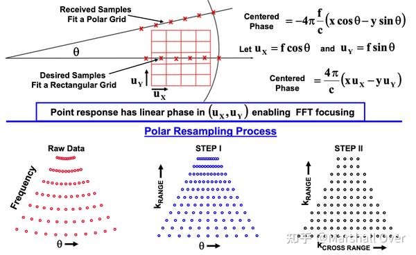
Polar ReSampling:
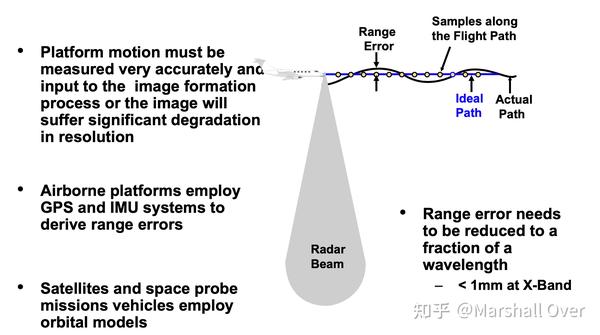
Motion Compensation:

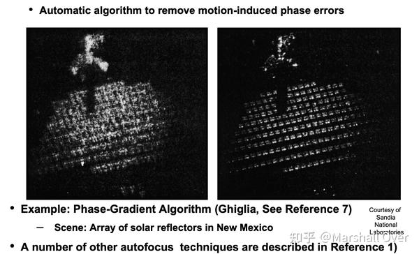
Autofocus Algorithm Techniques:

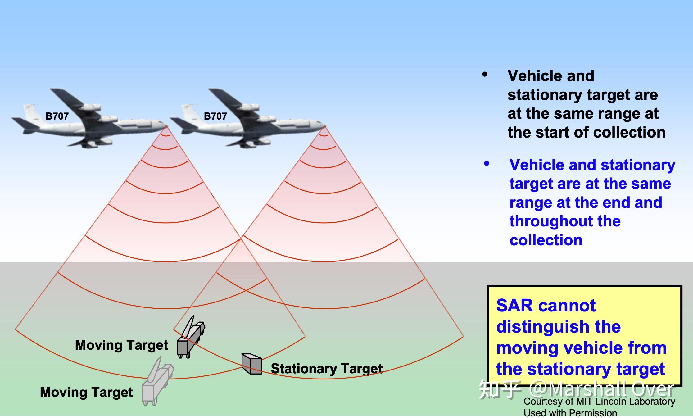
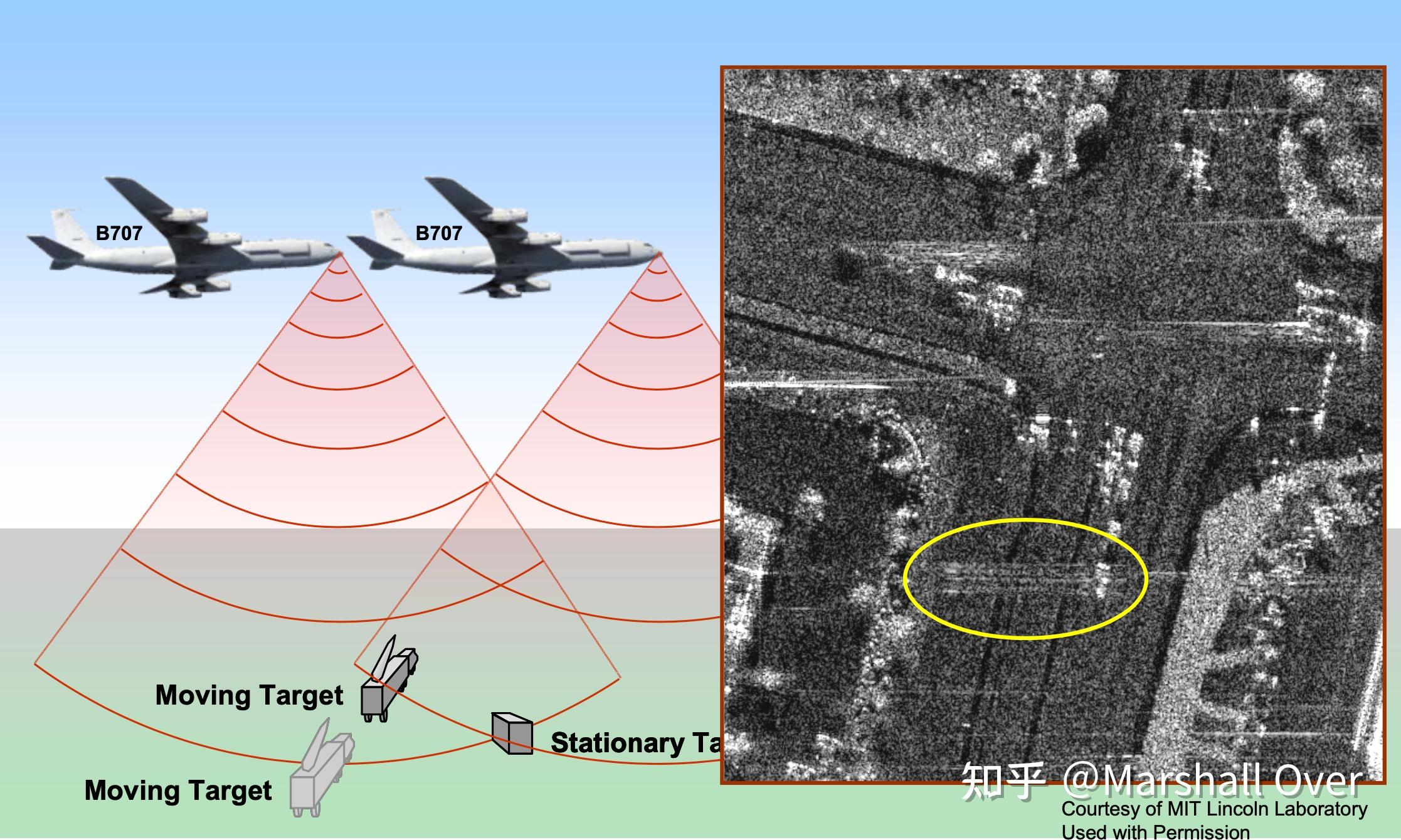
Moving Target Displacement in SAR:


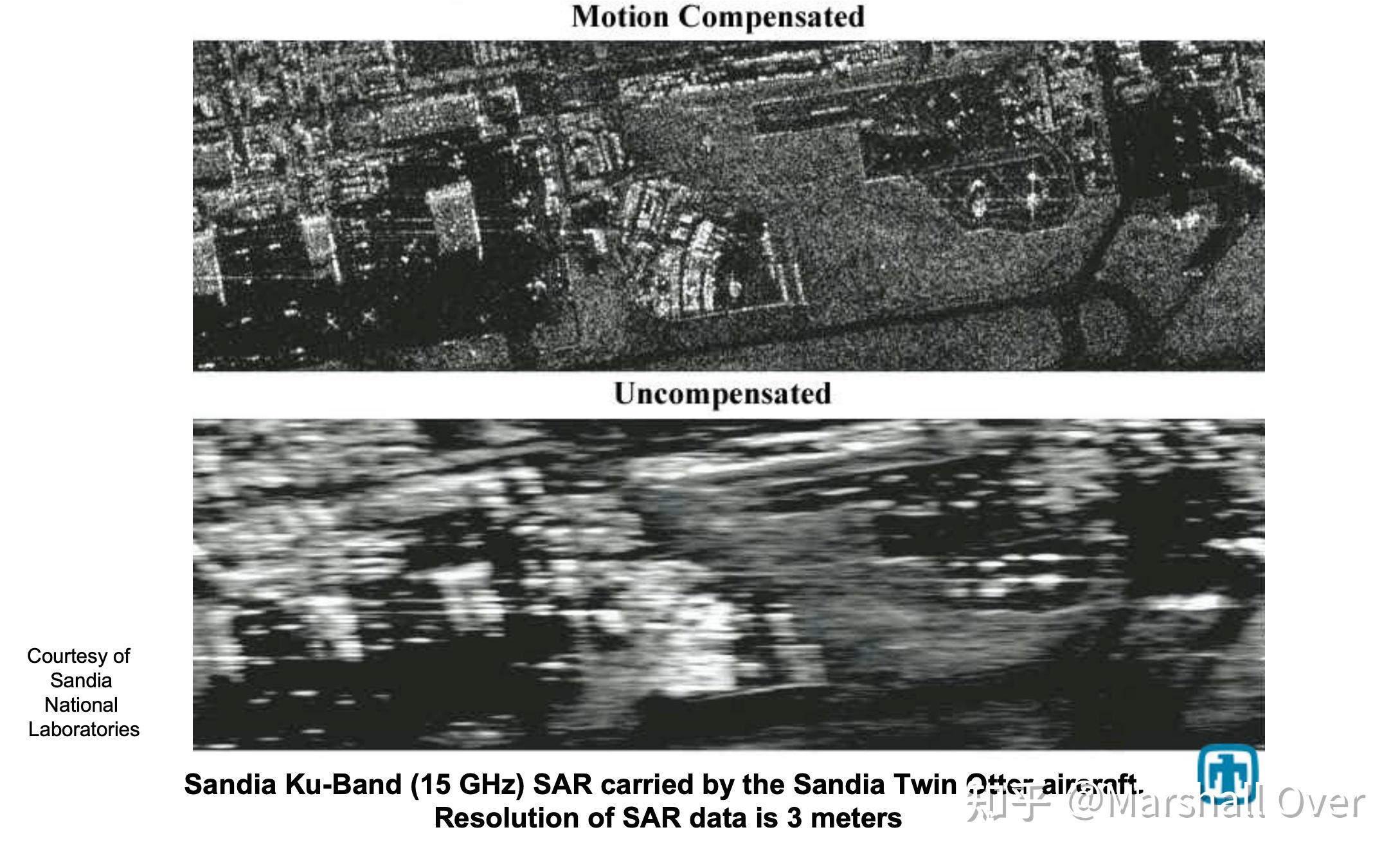
Motion Compensation Example:

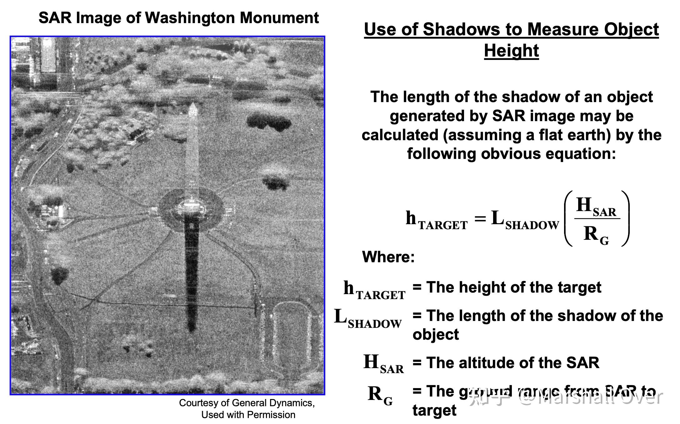
Shadowing of Ground Objects:

4 高阶图像形成技术
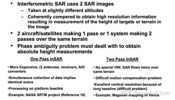
Interoferometric SAR (InSAR):

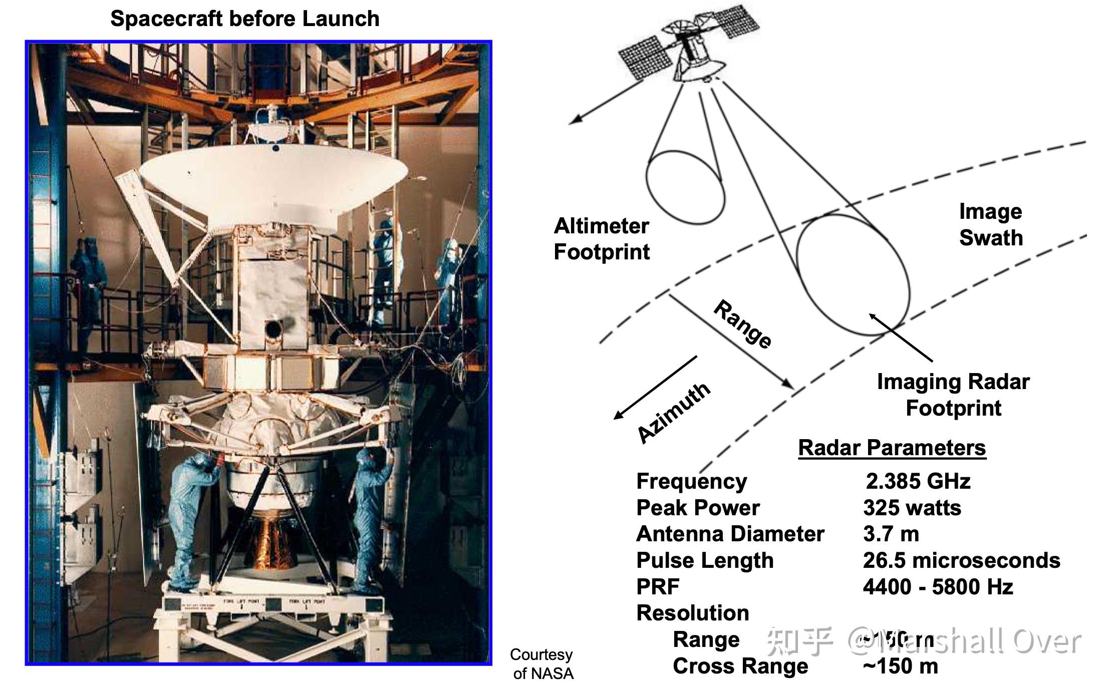
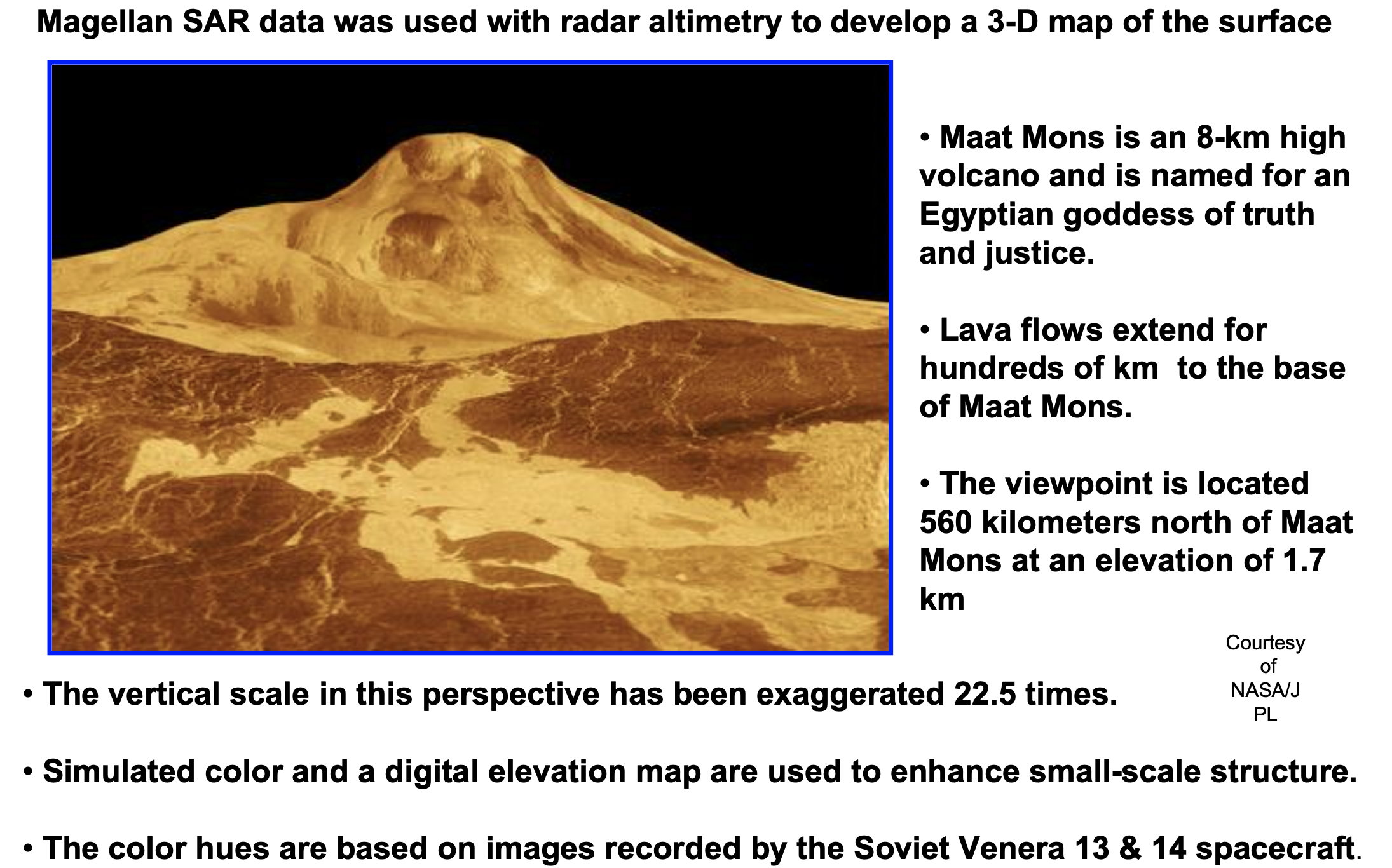
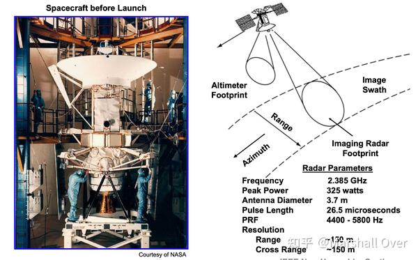
Synthetic Aperture Radar on Magellan Mission to Venus:

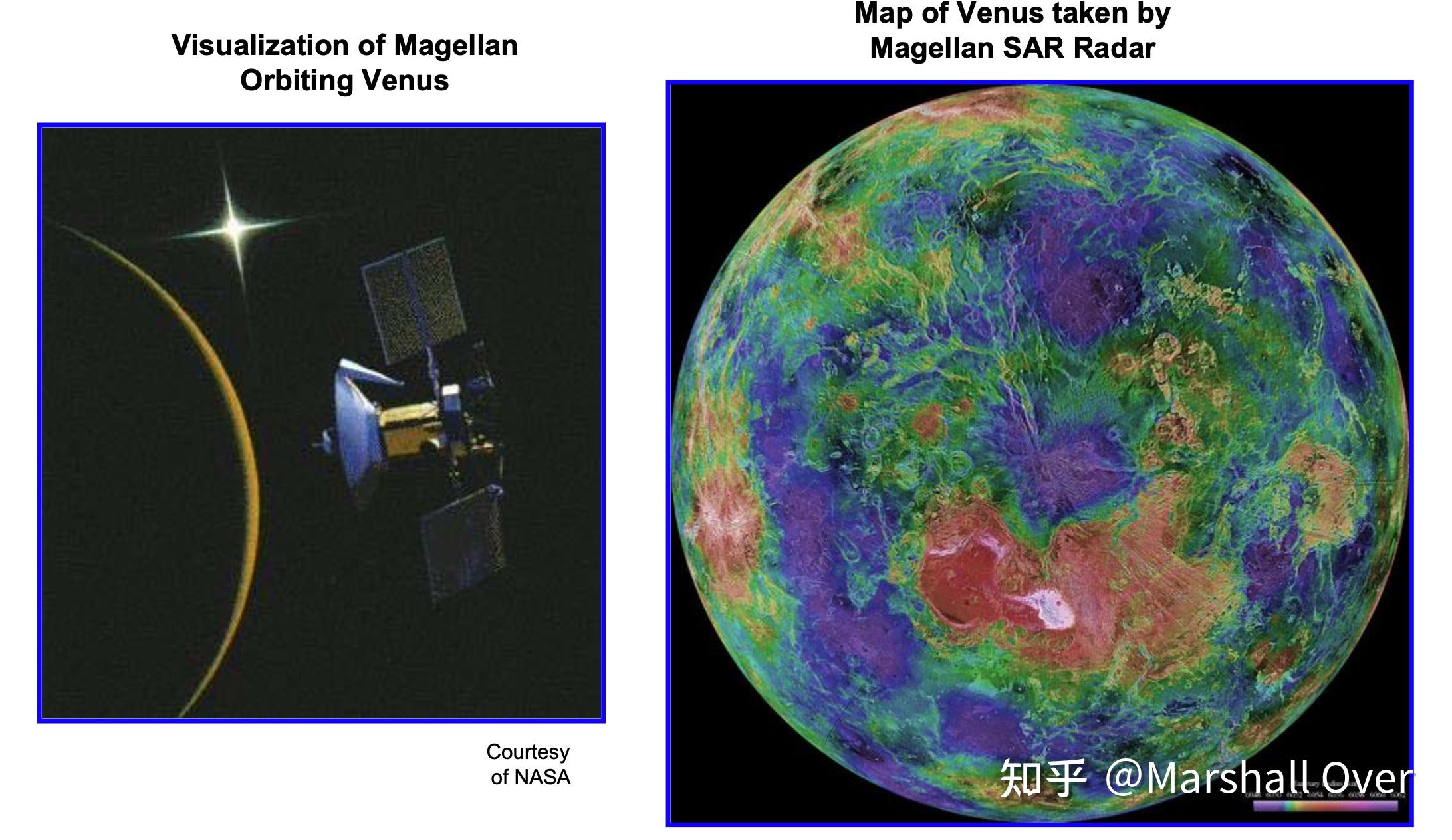
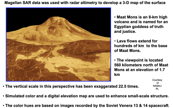
Magellan SAR Mapping of Venus:

Magellan Space Probe of Venus:
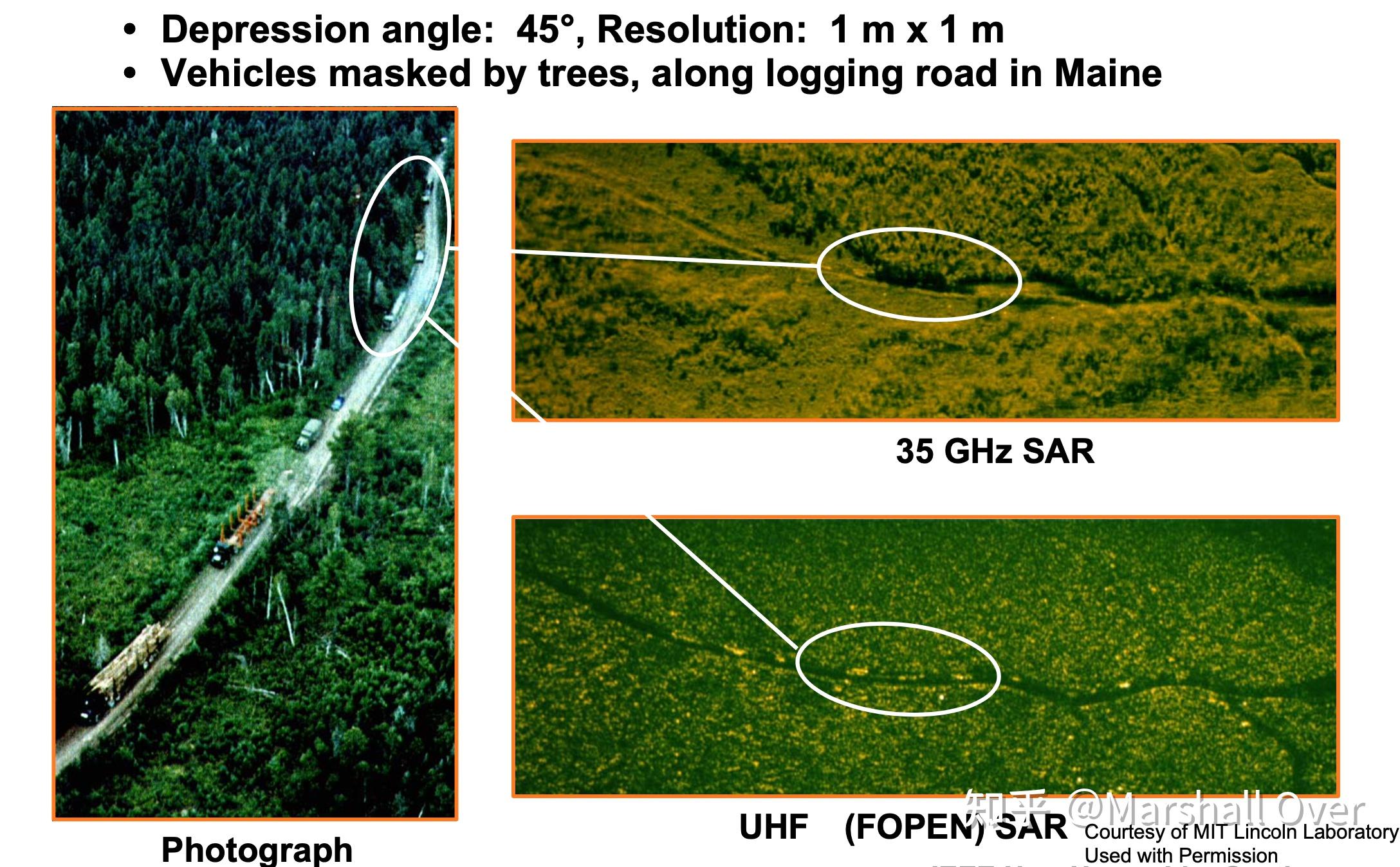
FOPEN – Foliage Penetration SAR:
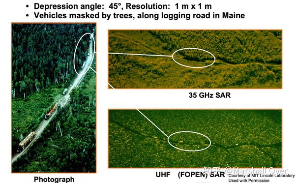
Microwave SAR & UHF SAR Comparison:
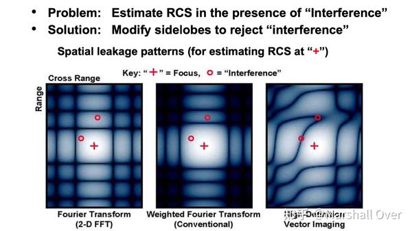
High-Definition Vector Imaging:

Image Reconstruction: A Comparison:
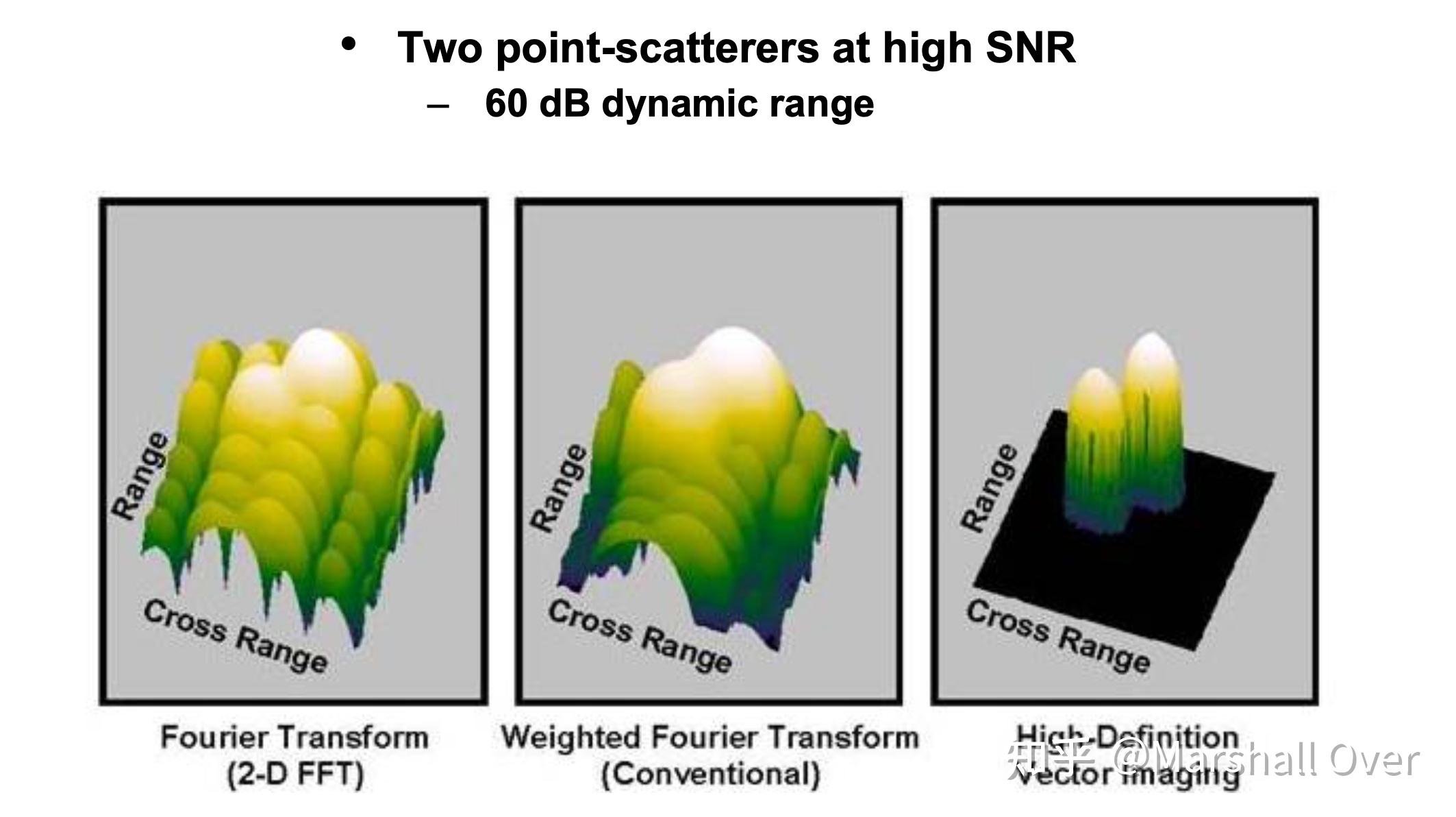
Controlling Sidelobes: An Inside Look:
5 SAR实例
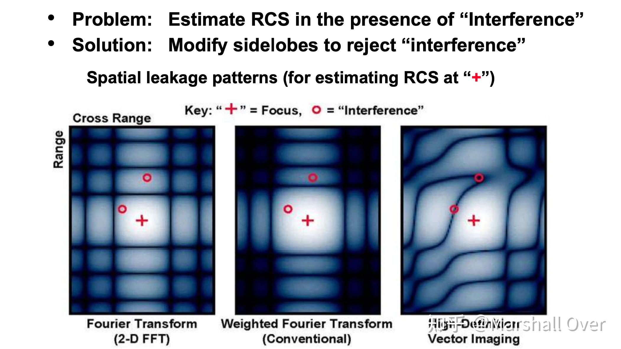
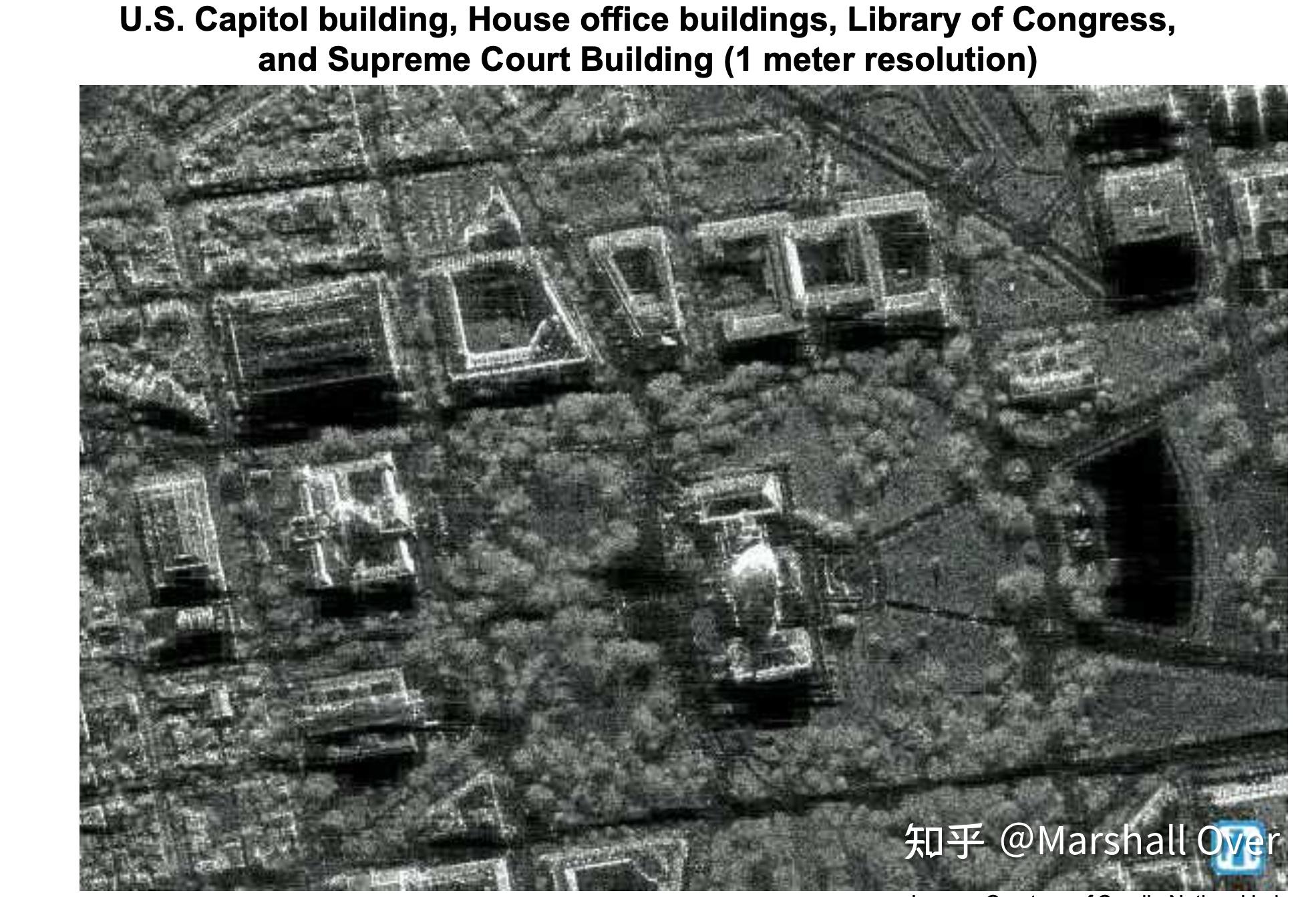
Sandia National Laboratory :KU-Band Synthetic Aperture Radar。

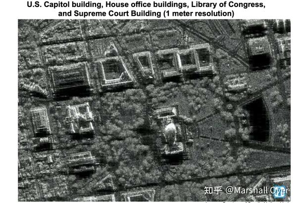
Sandia KU-Band SAR Image:
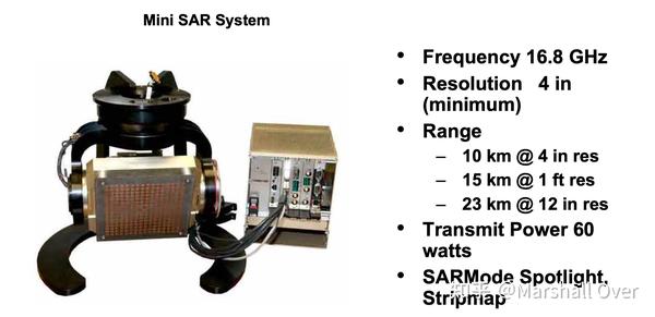
Sandia mini SAR:

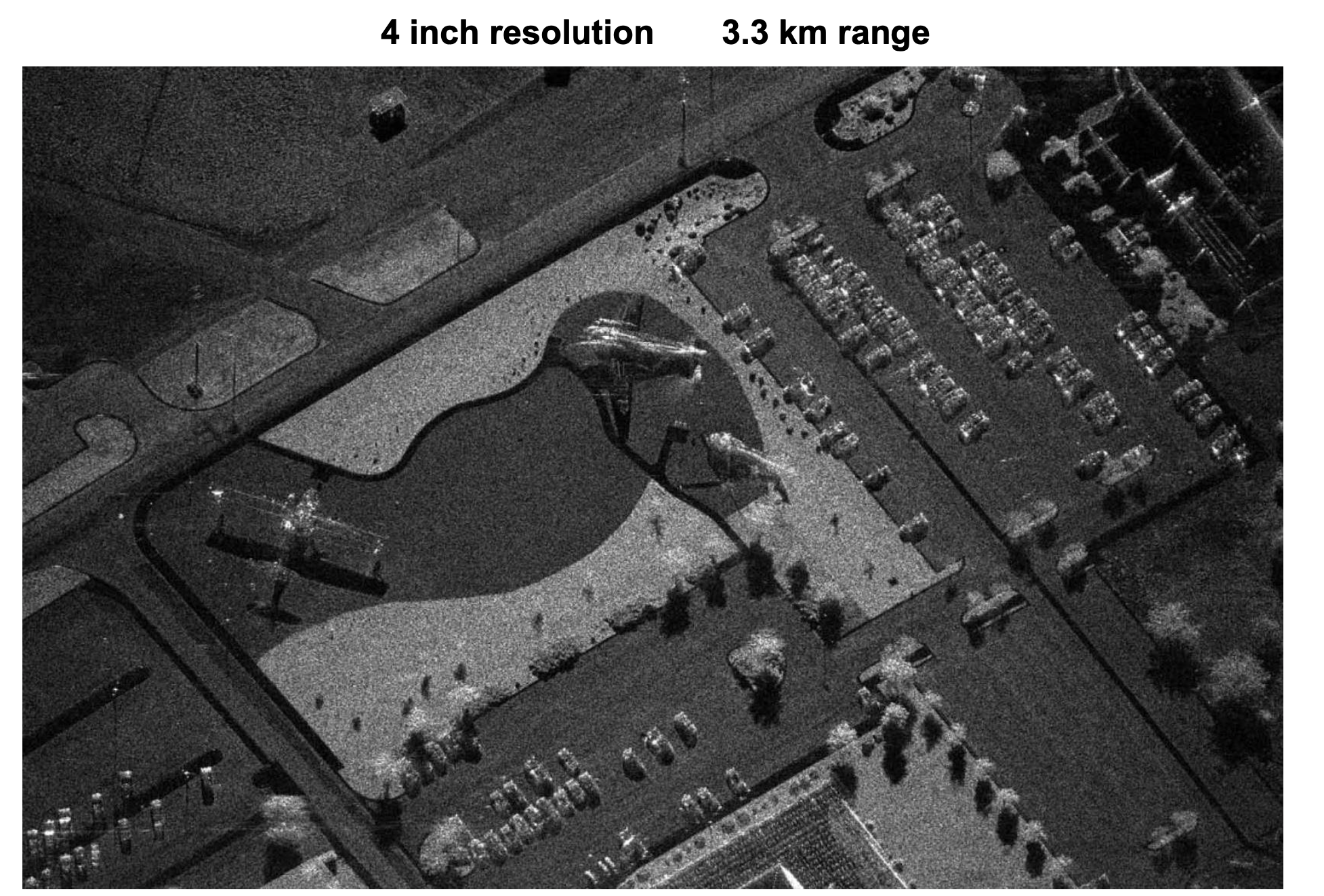
Sandia mini SAR: mini SAR Image DC-3 & Helicopter Static Display - KAFB。

Sandia Lynx SAR Radar:

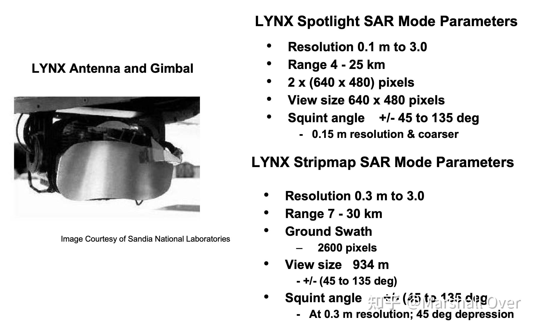
Sandia Lynx Image:
LiMIT Ultra-Wideband Frame Mode 2.5 in × 2.5 in Resolution ( BW = 3.0 GHz)。


6 遥感应用
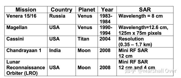
List of Space Probe SAR Systems:

Partial List of Earth Viewing SAR Satellites:
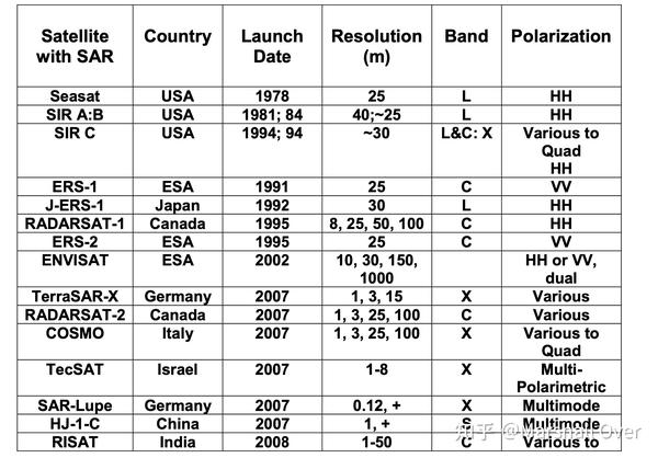
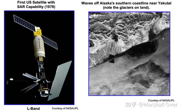
Seasat:
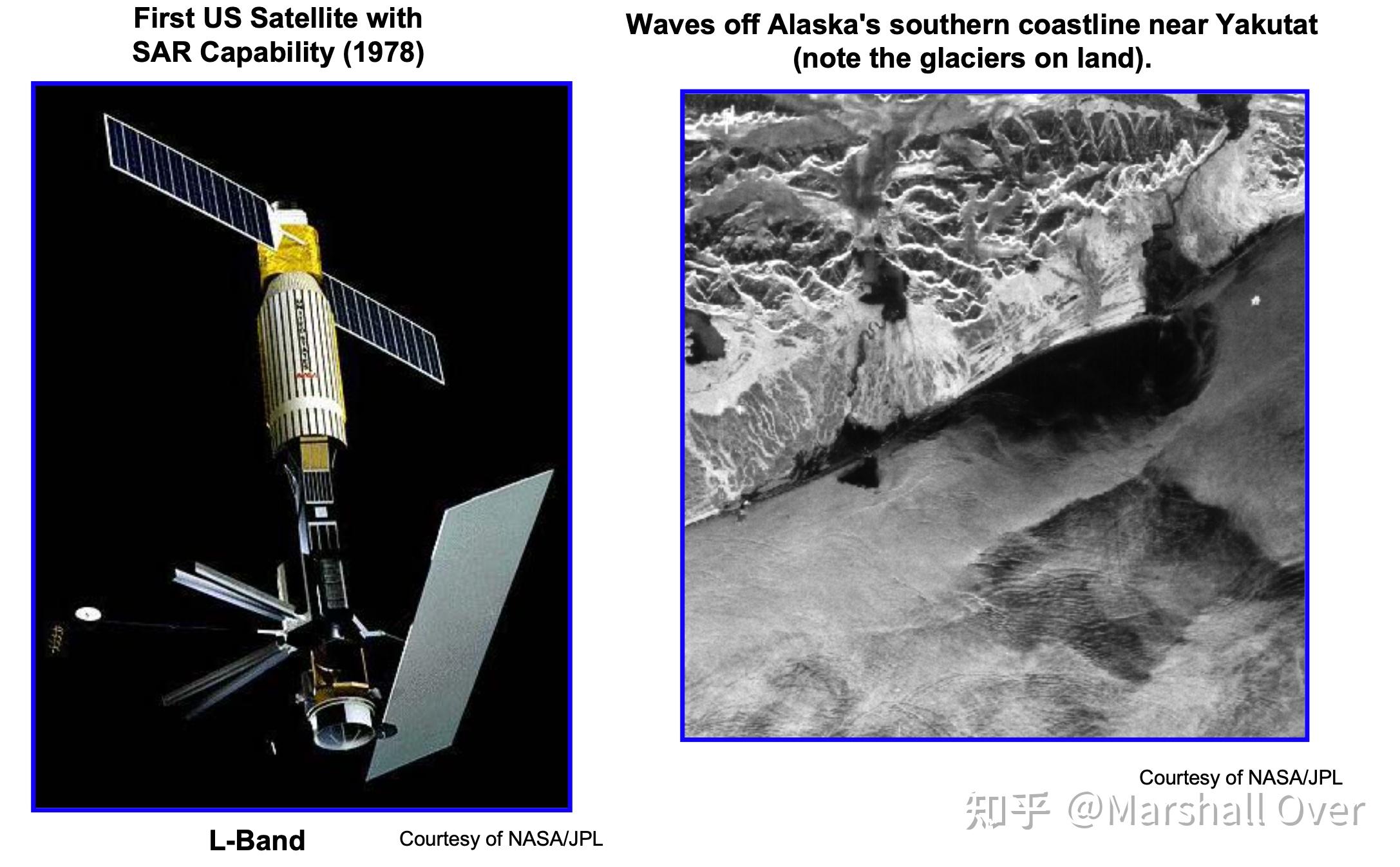
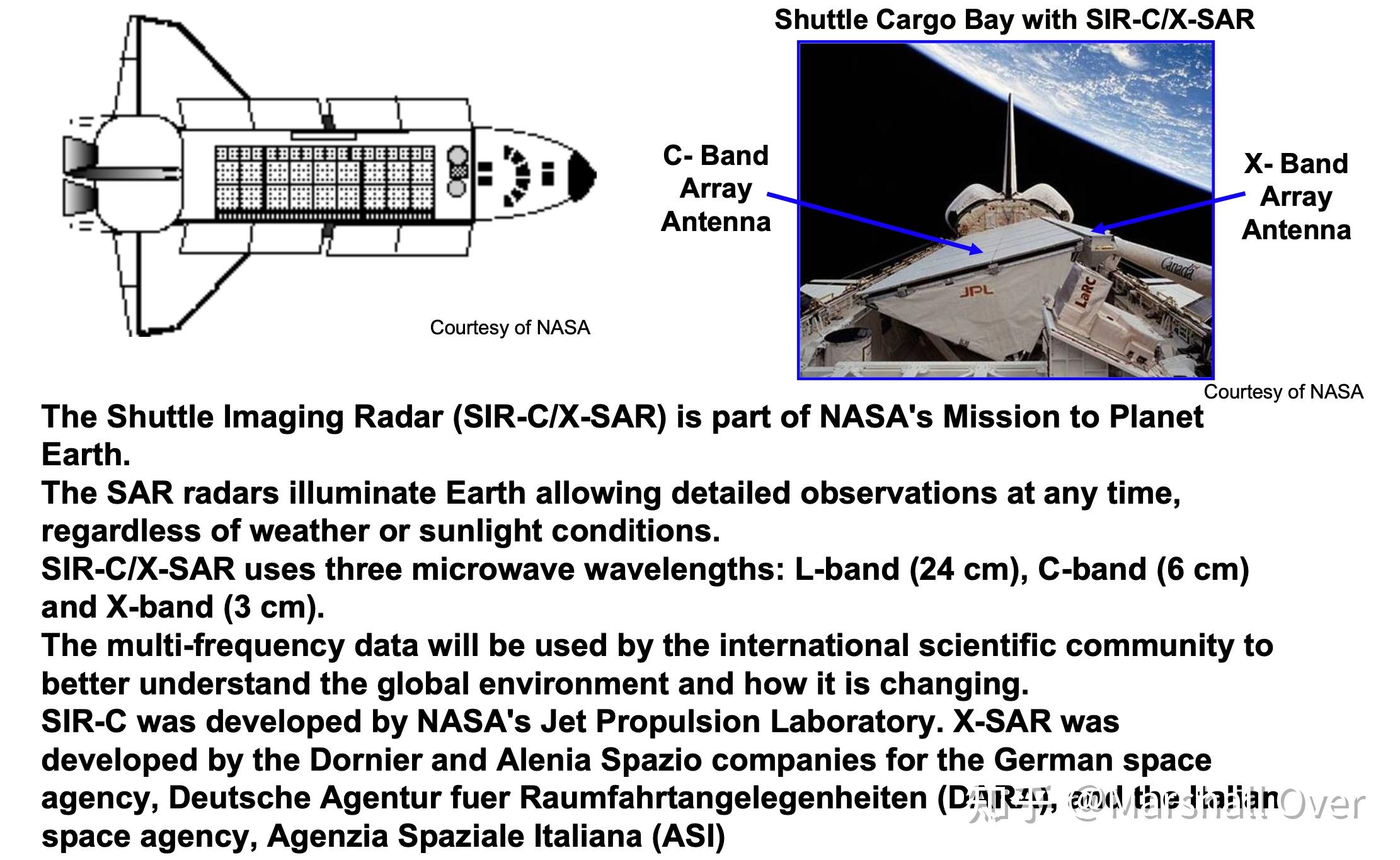
SIR (Shuttle Imaging Radar Series):

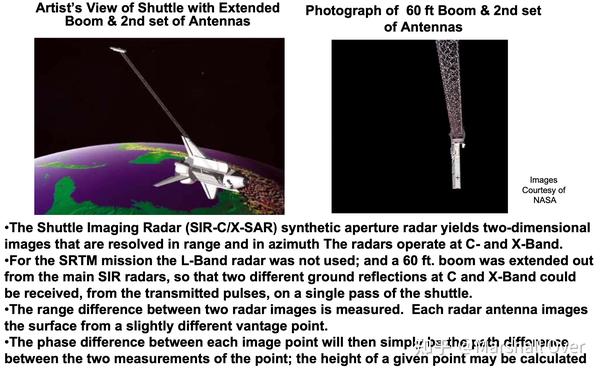
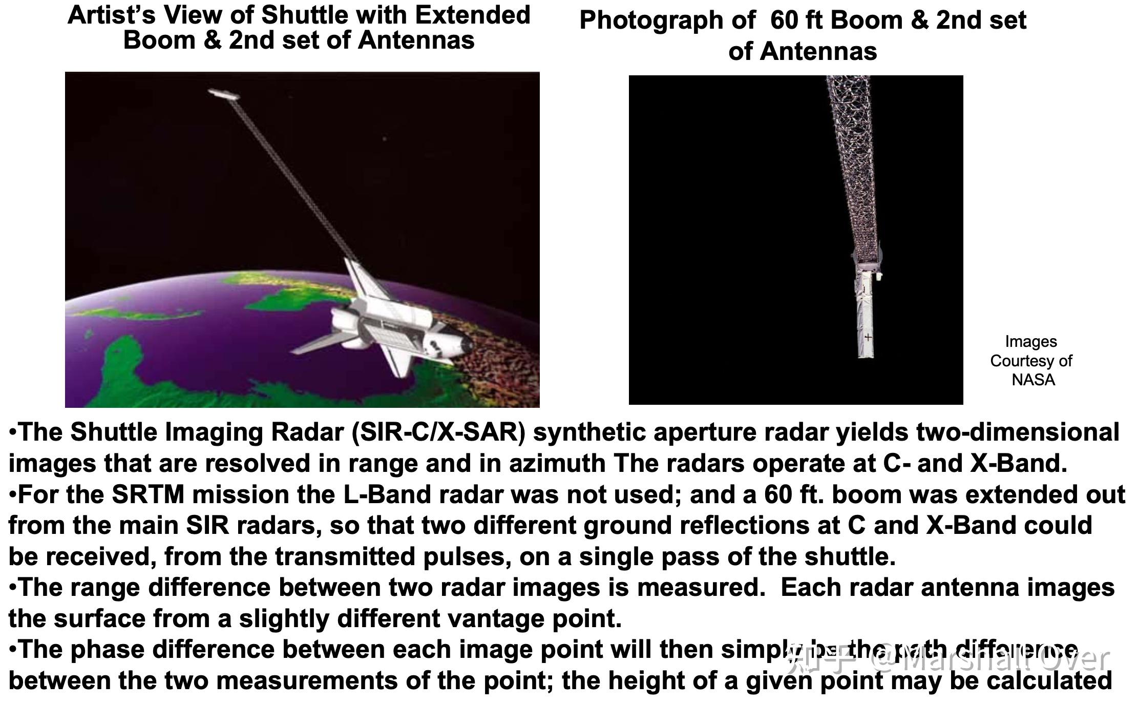
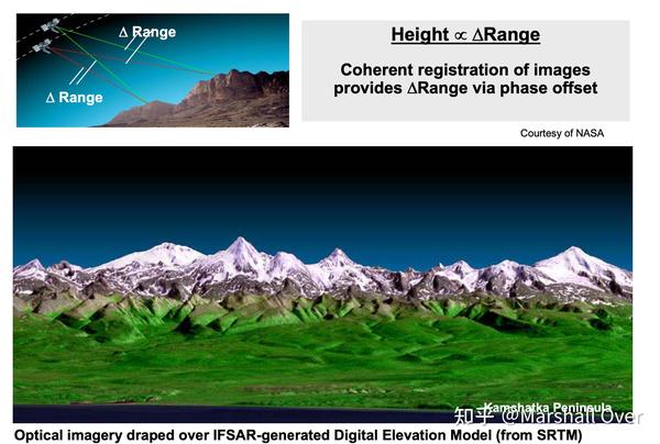
The Shuttle Radar Topography Mission (SRTM):
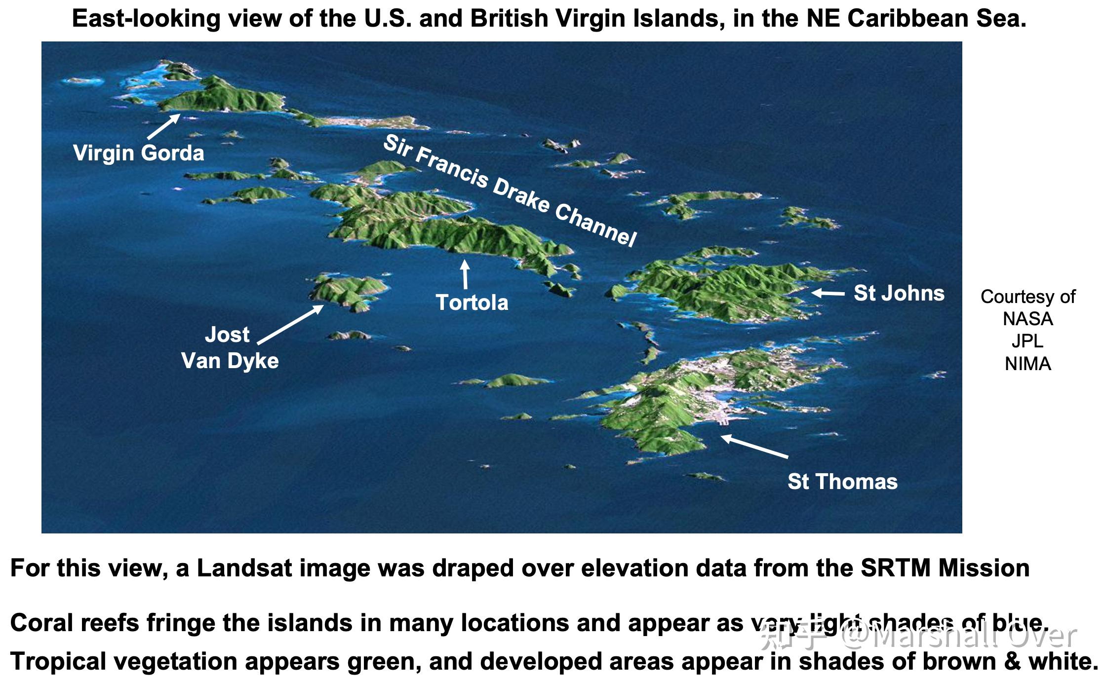
SRTM SAR Image of Virgin Islands:

SRTM Interferometric SAR Image:

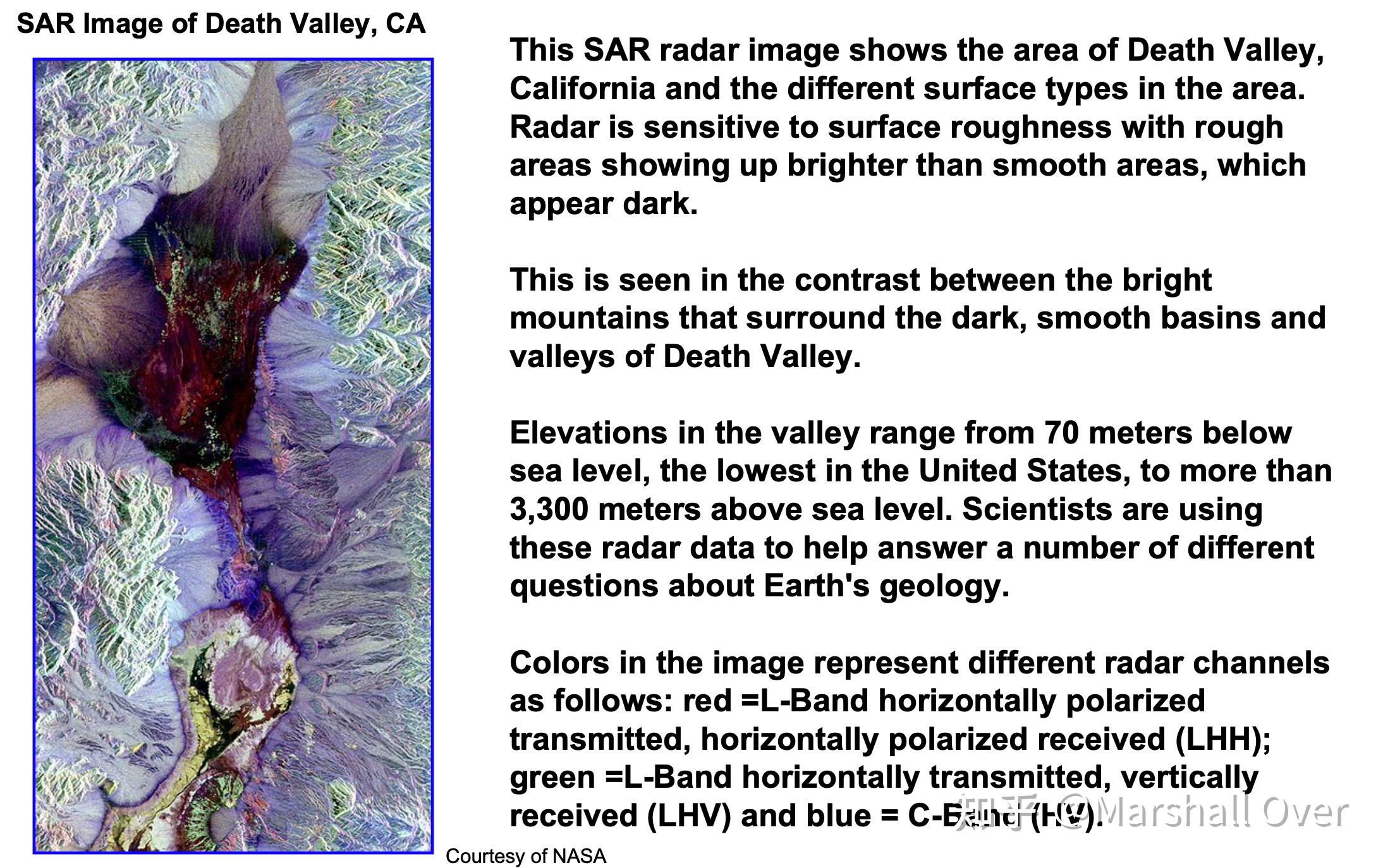
SIR (C/X) Band SAR Image: SAR Image of Death Valley, CA。

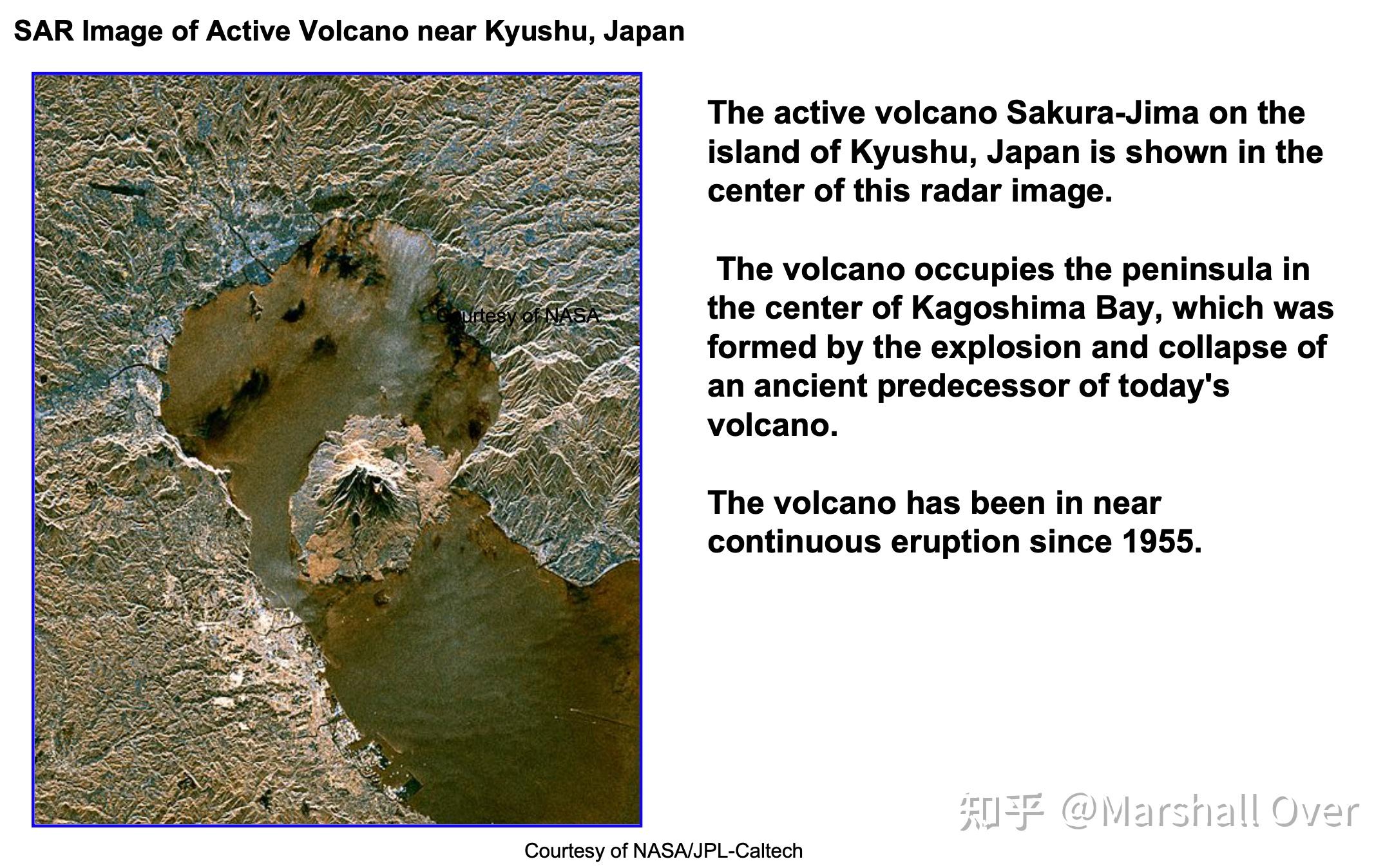
SIR (C/X) Band SAR Image: SAR Image of Active Volcano near Kyushu, Japan。

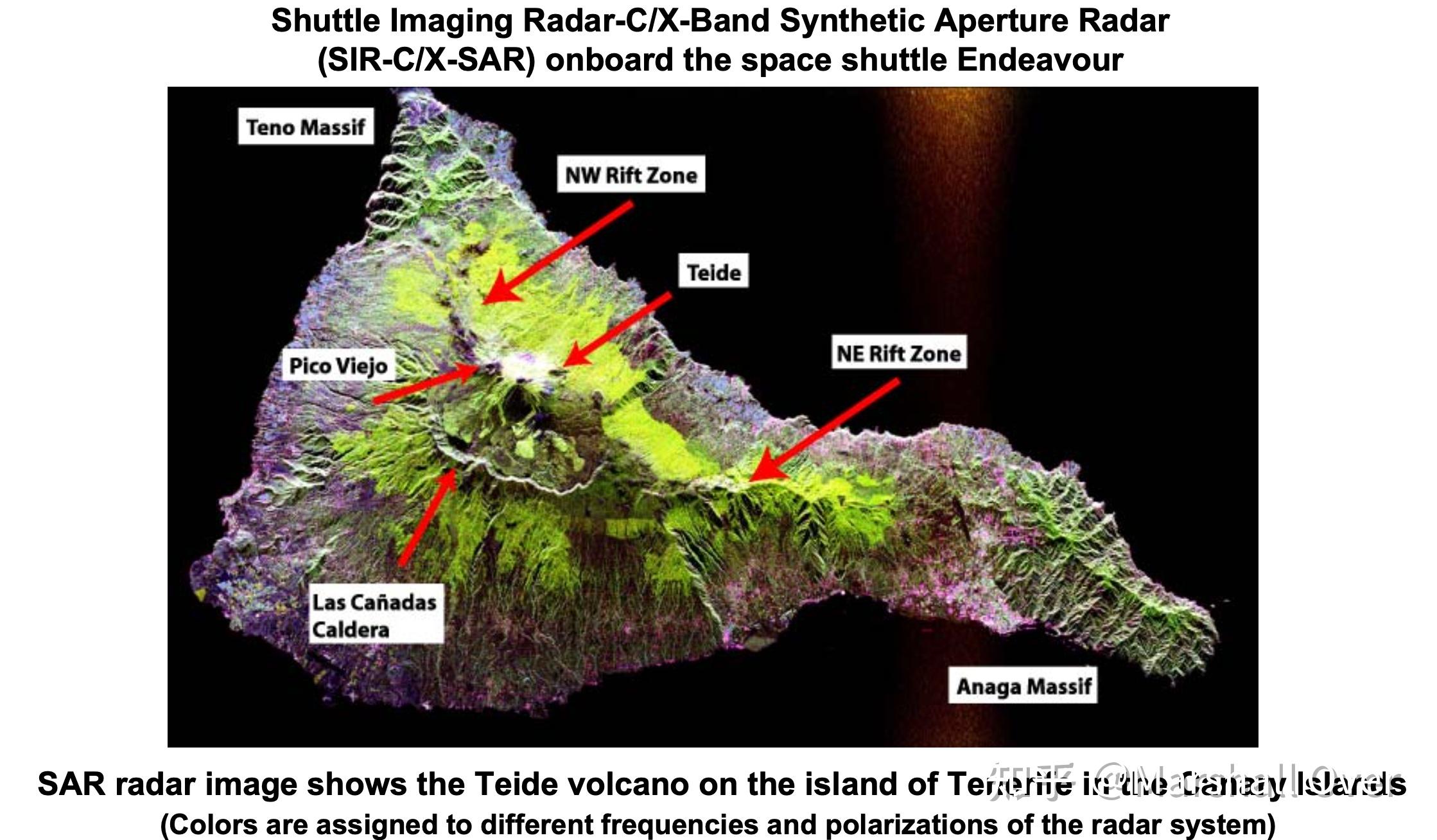
SIR (C/X) Band SAR Image: SAR radar image shows the Teide volcano on the island of Tenerife in the Canary Islands。

ERS-1 and ERS-2:

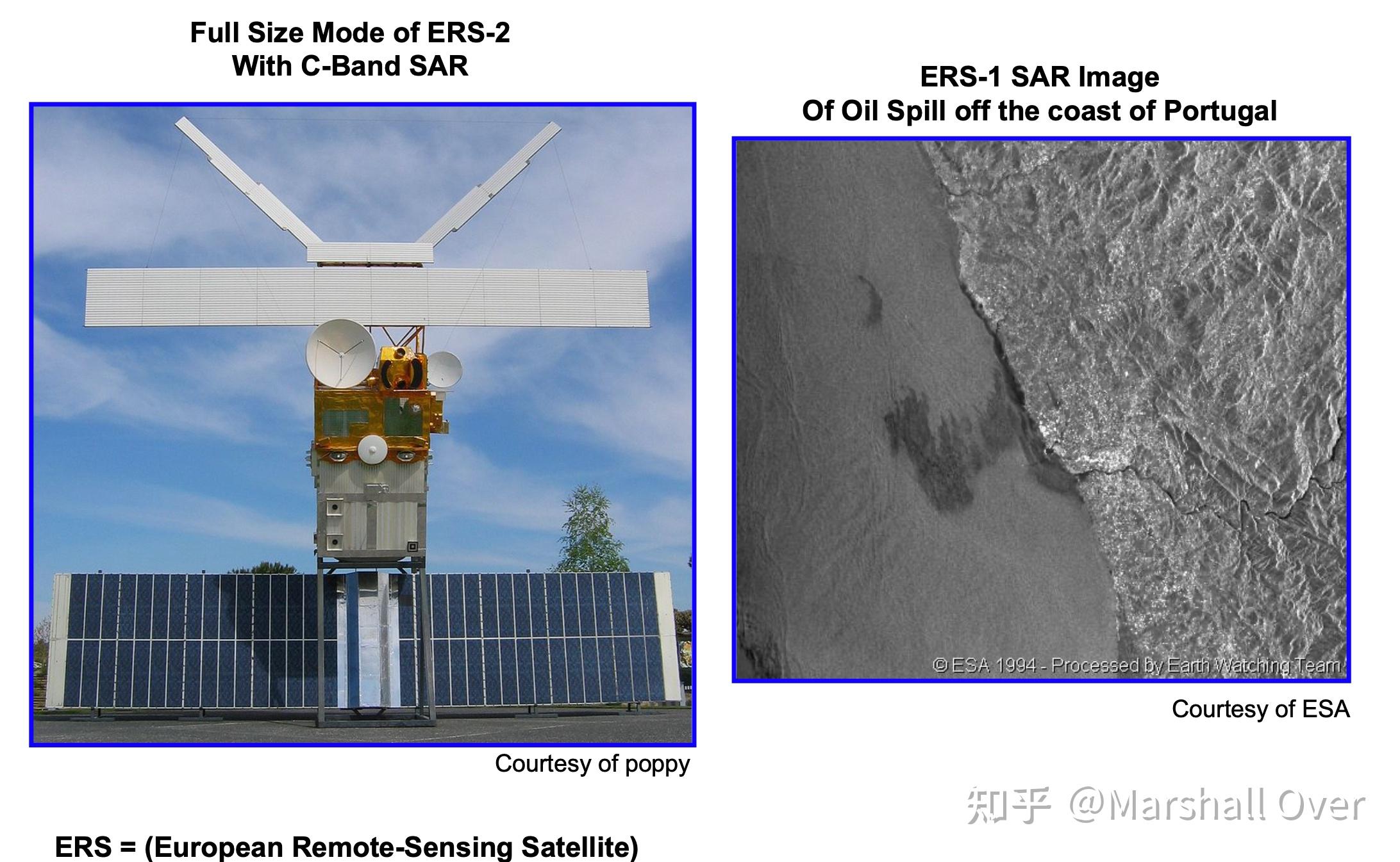
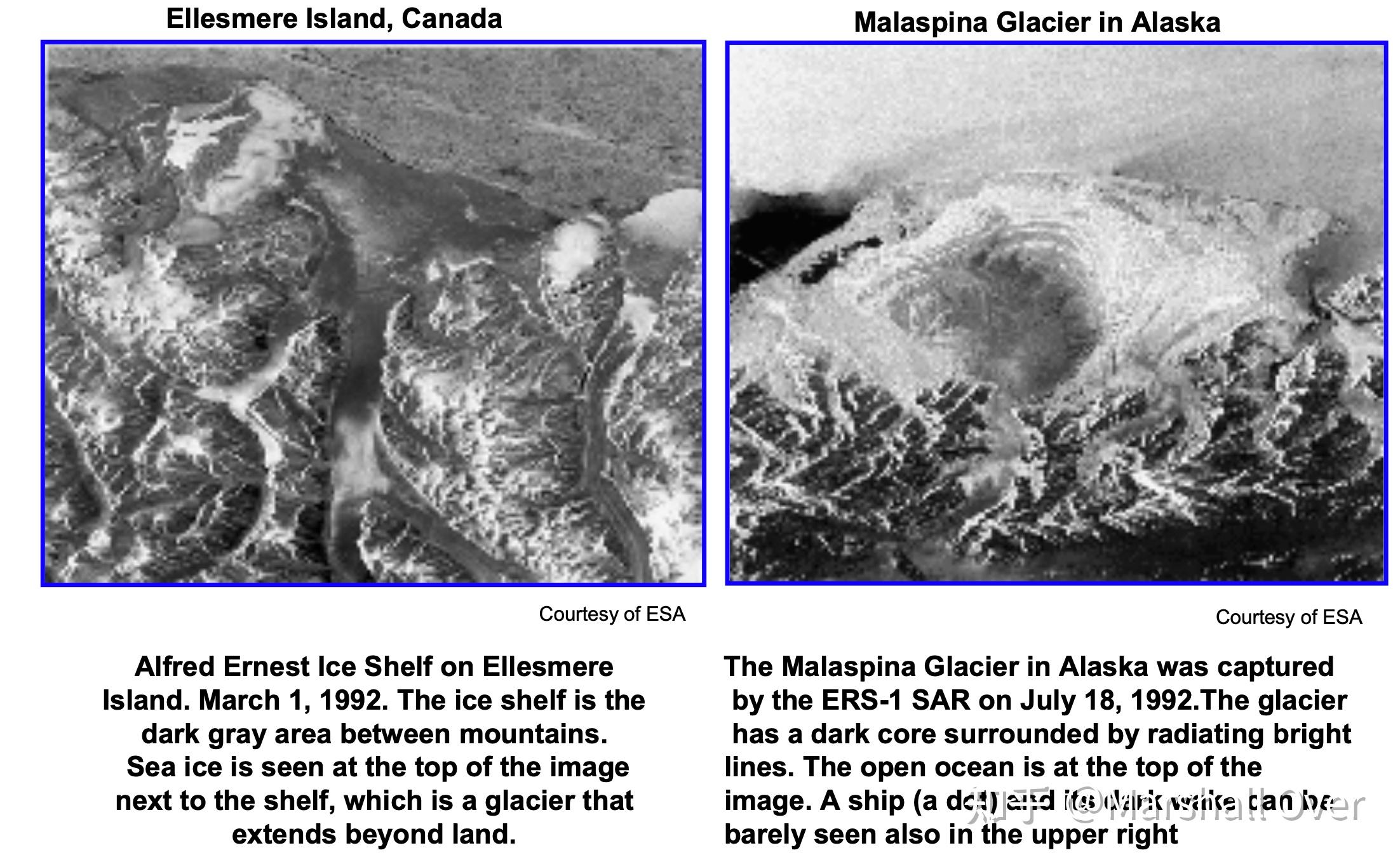
ERS-1 Images:

RADARSAT-1:
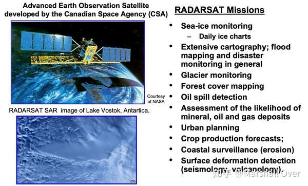
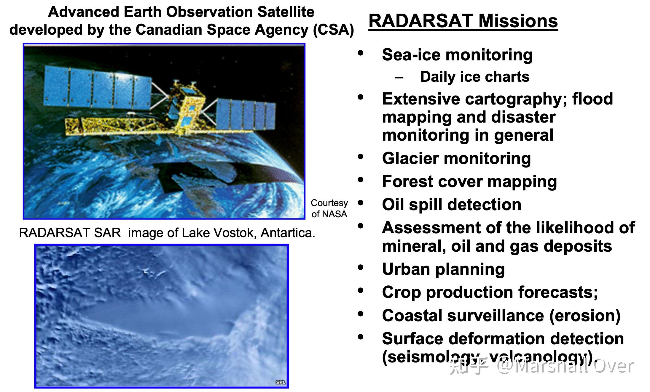
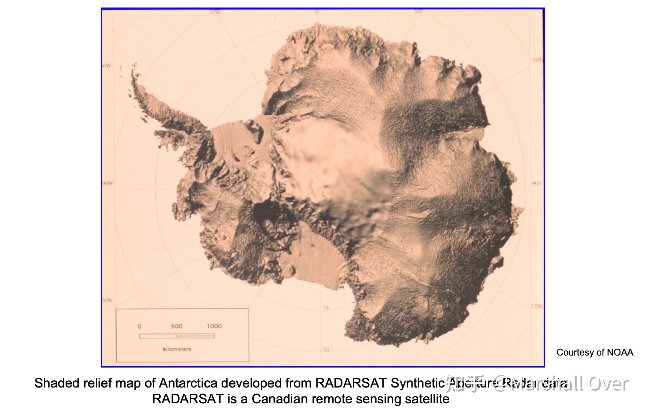
RADARSAT-1 Image of Antarctica:

List of Space Probe SAR Systems:

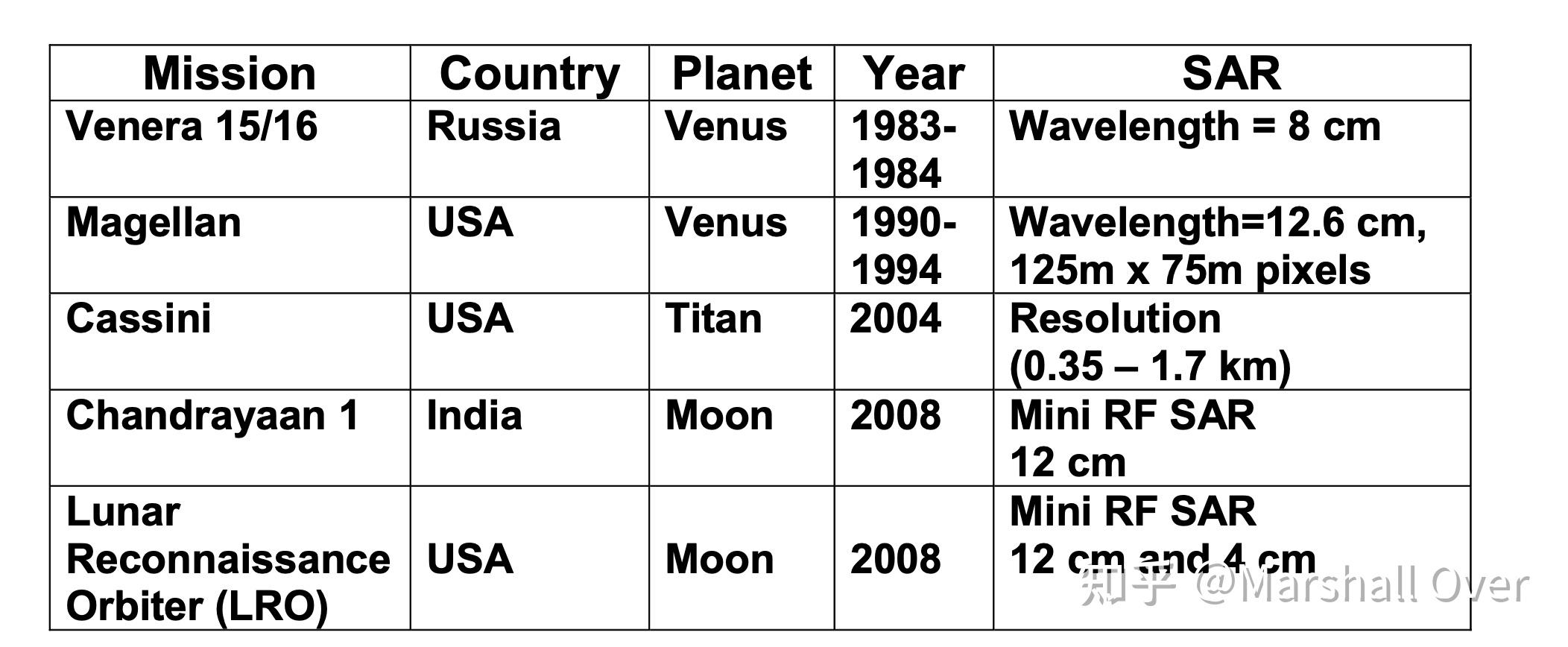
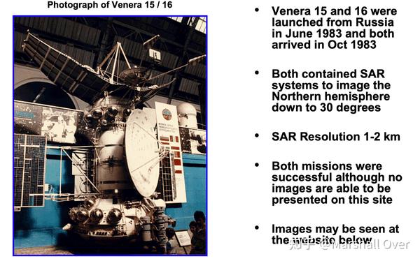
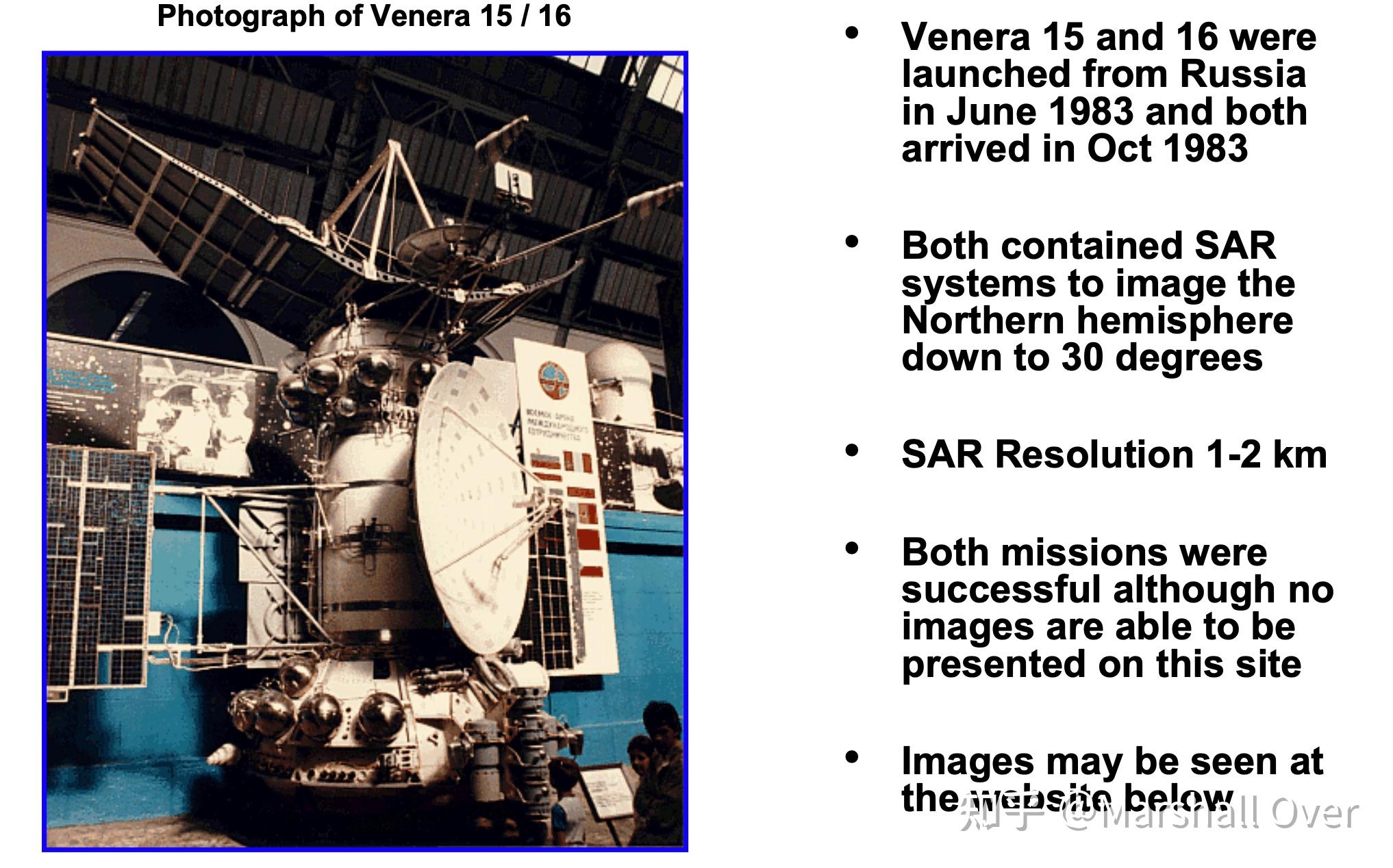
Venera:
Synthetic Aperture Radar on Magellan Mission to Venus:
SAR Images of Venus with Magellan:
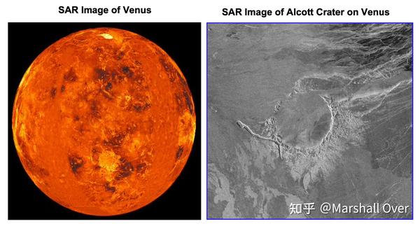

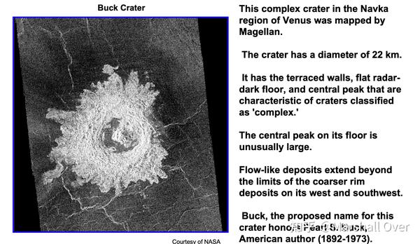
Magelllan SAR Image of Buck Crater:
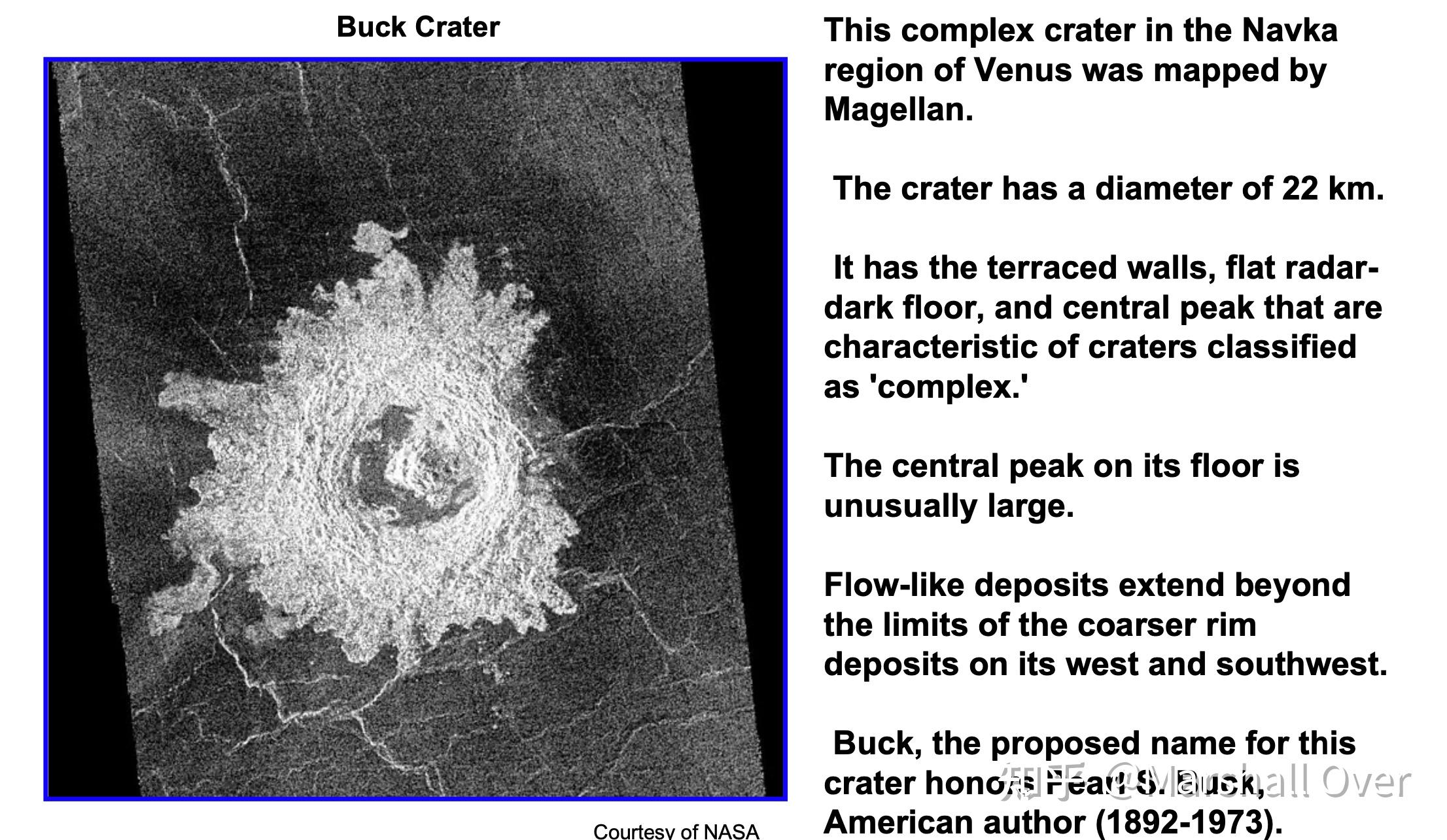
Magellan SAR Images from Left and Right Aspects:

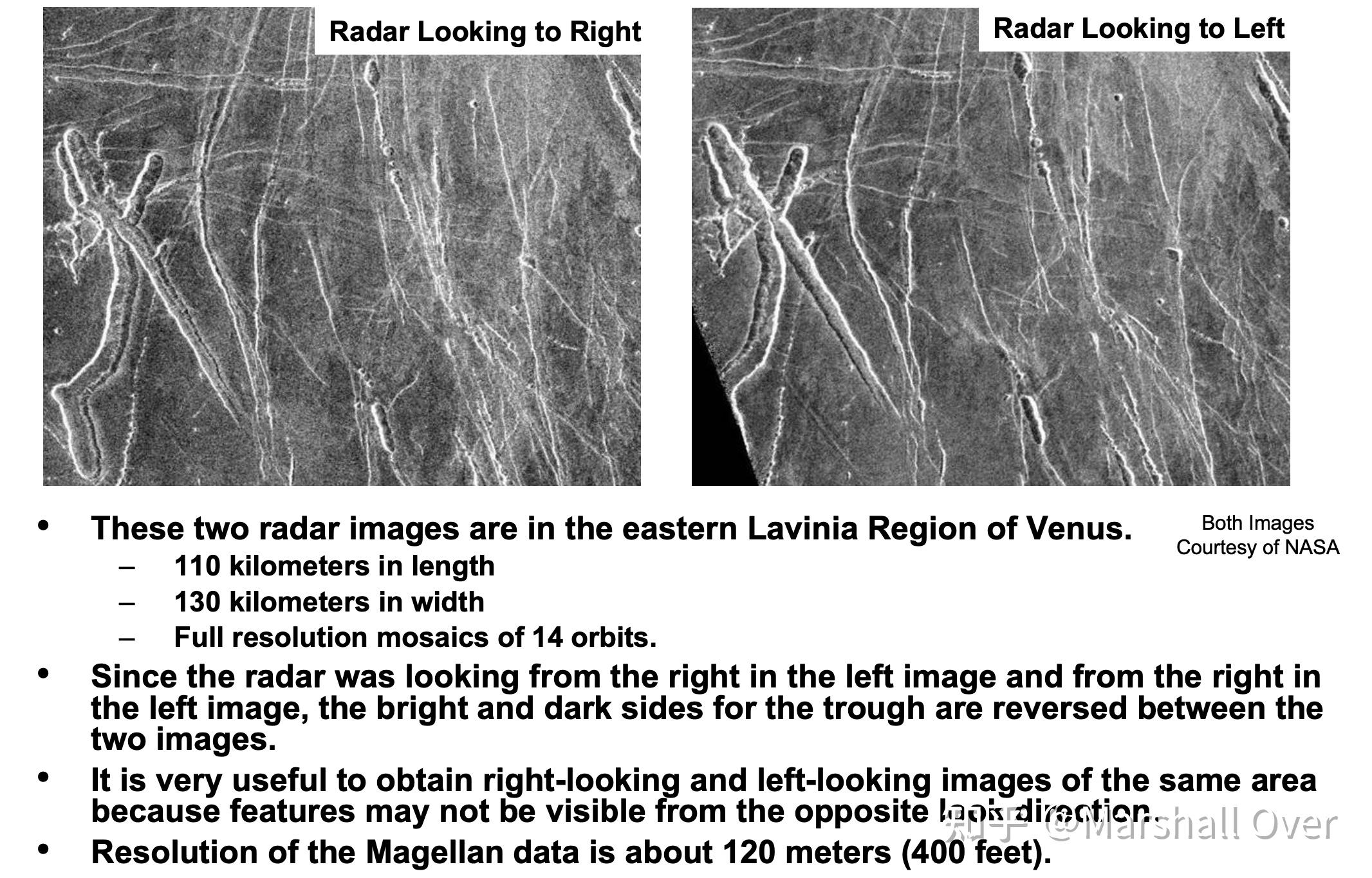
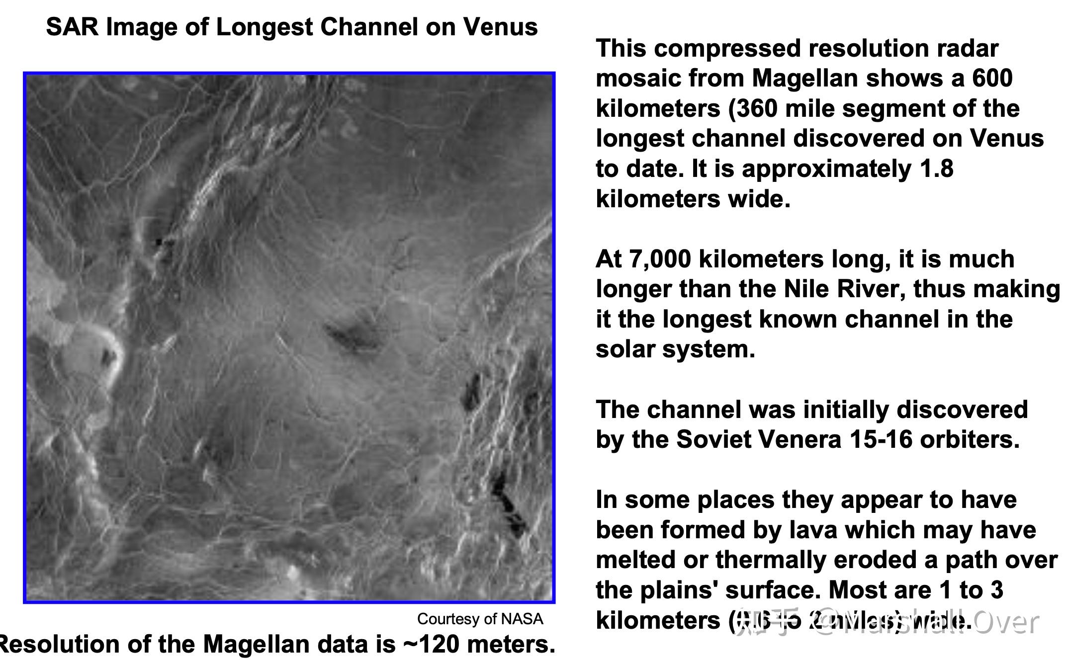
SAR Image of 600 Kilometer Segment of Longest Channel on Venus:
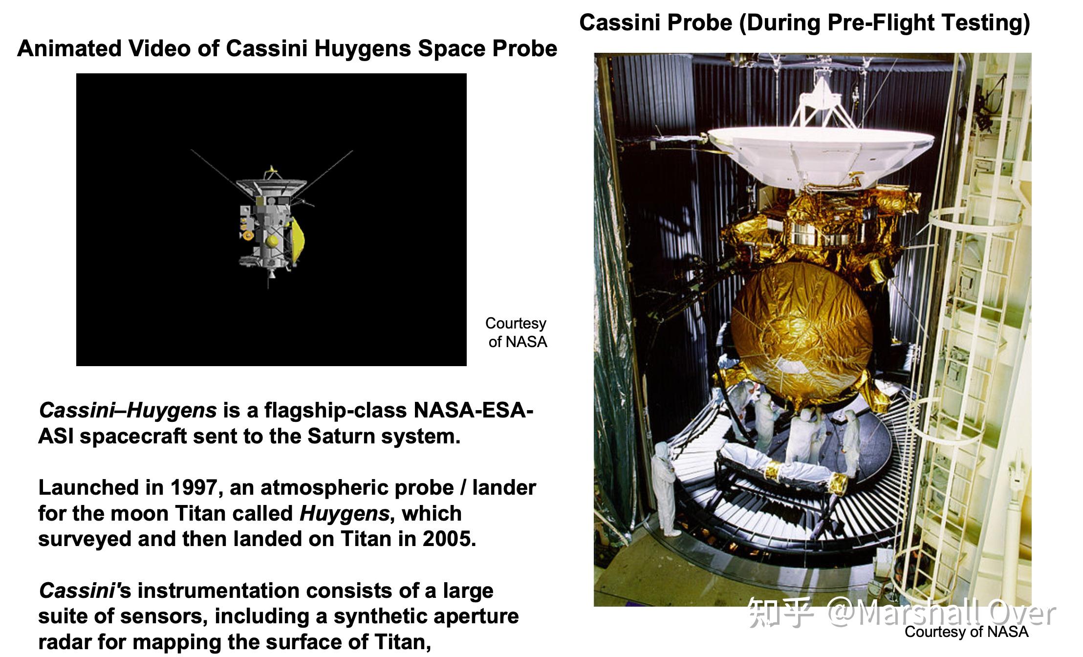
Cassini Space Probe to Saturn:

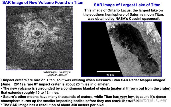
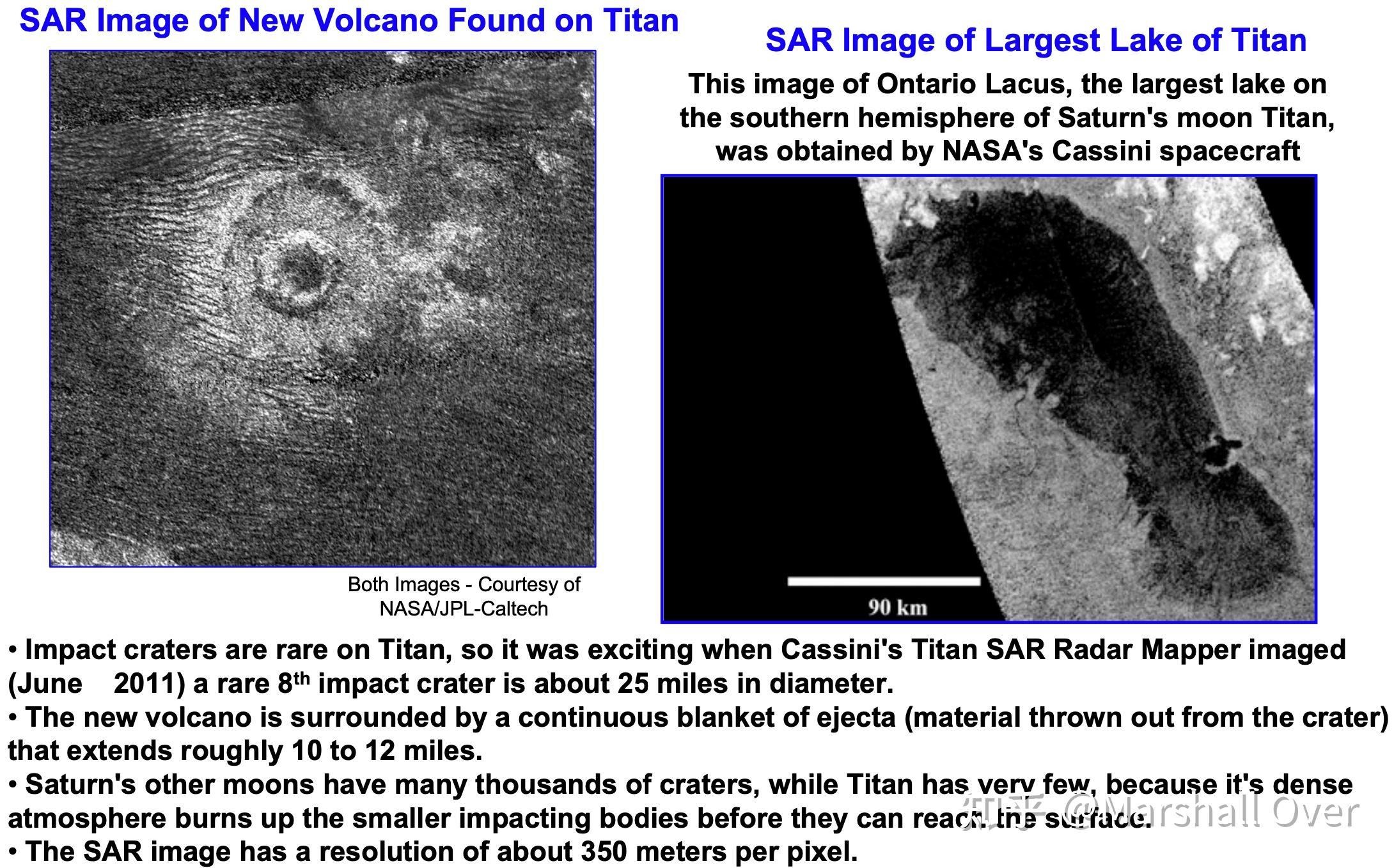
Cassini SAR Images of Titan, Saturn’s Largest Moon:
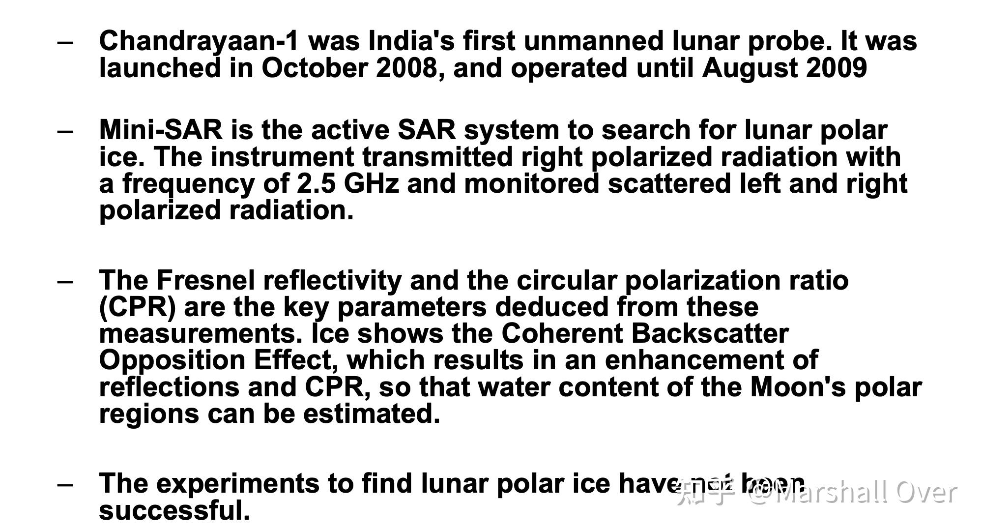
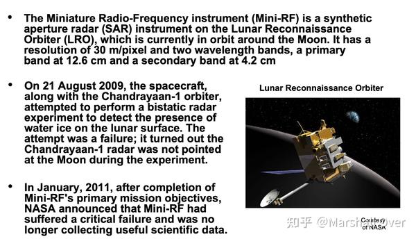
Chandrayaan 1:

Lunar Reconnaissance Orbiter (LRO):

7 总结讨论
Summary:

8 参考文献
[1] 百度翻译
[2] MIT 公开课: Radar Systems Engineering